
36 (super)
Cycle Route 36 Super
A collection of 15 cycling routes.
Overview
About this collection
A clean, city-friendly set of rides built around Route 36. Expect a mostly smooth roll on asphalt and other paved surfaces, with regular bike-lane stretches and some quieter side streets linking things together. There are brief surprises—short gravel or ground patches and the odd wood/metal crossing (think bridges and boardwalks)—but they’re tiny compared to all the tarmac. The vibe is urban: lots of main-road sections, so plan for traffic and watch the junctions and pedestrian areas. Any road or city bike will be right at home; you don’t need wide tires, though they won’t hurt for the occasional unpaved blip. If you want a calmer spin, aim for the cycleway segments or ride outside rush hour. Great for commuters, tempo rides, or anyone who likes a straightforward point‑to‑point feel with clear navigation.
- 15
- Routes
- -:--
- Duration
- 747.6 km
- Distance
- ---
- Avg. speed
- 7,518 m
- Ascent
- 7,649 m
- Descent
Cycle Route 36 Super
Routes in this collection
All 15 routes in this collection can be opened on the map or in the Bikemap App for more details, where you can adjust them in the route planner, or download them as GPX or KML file. Use them as a template for planning your own rides, or let Bikemap navigate you along them directly.

Stage 36: Whiting to Calumet City
Cycling route in Whiting, Indiana, United States
- 11.6 km
- Distance
- 45 m
- Ascent
- 42 m
- Descent

36 (Indiana): Calumet City to Porter
Cycling route in Calumet City, Illinois, United States
- 50.2 km
- Distance
- 112 m
- Ascent
- 97 m
- Descent

Route 36: Porter to Long Beach
Cycling route in Porter, Indiana, United States
- 38.2 km
- Distance
- 128 m
- Ascent
- 130 m
- Descent

Pennsylvania 36: Cambridge Springs to Pymatuning Central
Cycling route in Cambridge Springs, Pennsylvania, United States
- 55.7 km
- Distance
- 454 m
- Ascent
- 395 m
- Descent

Route 36: Corry to Cambridge Springs
Cycling route in Corry, Pennsylvania, United States
- 45.7 km
- Distance
- 481 m
- Ascent
- 406 m
- Descent

36: Warren to Corry
Cycling route in Warren, Pennsylvania, United States
- 60.7 km
- Distance
- 452 m
- Ascent
- 525 m
- Descent

Route 36 (PA): Smethport to Warren
Cycling route in Smethport, Pennsylvania, United States
- 80.6 km
- Distance
- 681 m
- Ascent
- 563 m
- Descent

Route 36 (Pennsylvania): Coudersport to Smethport
Cycling route in Coudersport, Pennsylvania, United States
- 48.1 km
- Distance
- 566 m
- Ascent
- 542 m
- Descent

36 (Pennsylvania): Coudersport to Wellsboro
Cycling route in Coudersport, Pennsylvania, United States
- 72.1 km
- Distance
- 643 m
- Ascent
- 749 m
- Descent
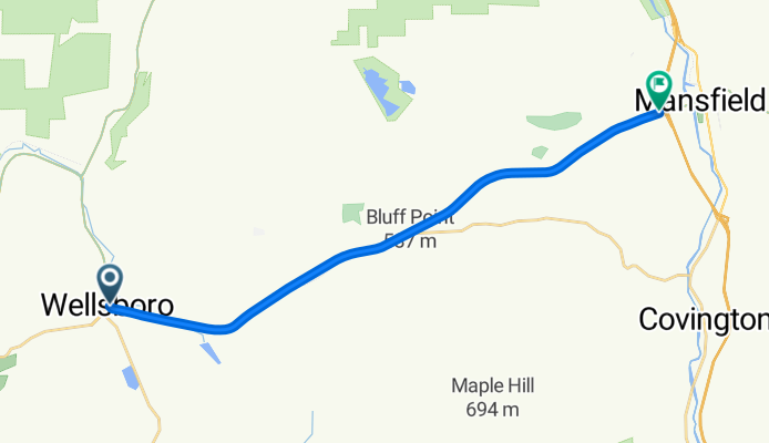
Route 36 (PA): Wellsboro to Mansfield
Cycling route in Wellsboro, Pennsylvania, United States
- 19 km
- Distance
- 299 m
- Ascent
- 313 m
- Descent

Route 36 (PA): Mansfield to Troy
Cycling route in Mansfield, Pennsylvania, United States
- 28.1 km
- Distance
- 401 m
- Ascent
- 426 m
- Descent

36 (Pennsylvania): Troy to Tunkhannock
Cycling route in Troy, Pennsylvania, United States
- 96.5 km
- Distance
- 1,312 m
- Ascent
- 1,461 m
- Descent