
Mur Bike Path Right Bank (AT)
Mur Cycle Path – Right Bank (Austria)
A collection of 14 cycling routes.
Overview
About this collection
Cruise the right bank of the Mur River on a relaxed mix of cycleways and quiet roads. This collection strings together riverside stretches with mostly smooth pavement and a few short gravel or track sections, so a touring or hybrid bike works great.
Expect easy river views, calm riding for long spells, and convenient stops in towns along the valley. There are occasional busier road crossings and brief rough patches near bridges or levees, but most of the way feels straightforward and scenic.
Ride a single section for a mellow day out or link multiple parts for a longer tour. You can switch sides via bridges when you want a different perspective, and the route works well in either direction. Surfaces and gradients vary by segment, so slightly wider tires help if you plan to explore the gravel bits.
- 14
- Routes
- -:--
- Duration
- 352.6 km
- Distance
- ---
- Avg. speed
- 4,943 m
- Ascent
- 3,425 m
- Descent
Mur Cycle Path – Right Bank (Austria)
Routes in this collection
All 14 routes in this collection can be opened on the map or in the Bikemap App for more details, where you can adjust them in the route planner, or download them as GPX or KML file. Use them as a template for planning your own rides, or let Bikemap navigate you along them directly.

Murradweg linkes Ufer – Abschnitt 6: Gornja Radgona – Mureck
Cycling route in Gornja Radgona, Gornja Radgona, Slovenia
- 35 km
- Distance
- 119 m
- Ascent
- 75 m
- Descent

Murradweg linkes Ufer – Abs. 6: Mureck–Spielfeld
Cycling route in Mureck, Styria, Austria
- 7.5 km
- Distance
- 38 m
- Ascent
- 44 m
- Descent

Murradweg linkes Ufer (AT): Spielfeld – Werndorf
Cycling route in Spielfeld, Styria, Austria
- 33.2 km
- Distance
- 103 m
- Ascent
- 42 m
- Descent
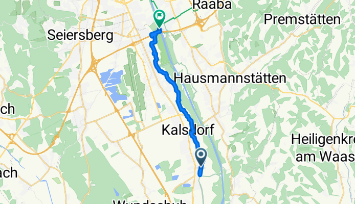
Murradweg rechtes Ufer – Abs. 4b: Feldkirchen bei Graz – Kalsdorf bei Graz
Cycling route in Feldkirchen bei Graz, Styria, Austria
- 11.1 km
- Distance
- 37 m
- Ascent
- 16 m
- Descent

Murradweg Abs. 4a Westufer (Frohnleiten - Graz)
Cycling route in Peggau, Styria, Austria
- 31 km
- Distance
- 371 m
- Ascent
- 299 m
- Descent

Murradweg rechtes Ufer – Abs. 4a: Frohnleiten → Peggau
Cycling route in Frohnleiten, Styria, Austria
- 7.5 km
- Distance
- 220 m
- Ascent
- 209 m
- Descent

Murradweg rechtes Ufer – Abs. 3: Niklasdorf–Frohnleiten
Cycling route in Niklasdorf, Styria, Austria
- 40.2 km
- Distance
- 462 m
- Ascent
- 356 m
- Descent

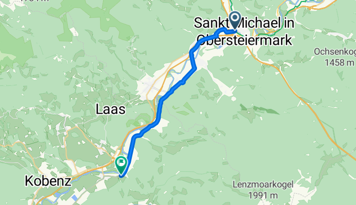
Murradweg linkes Ufer – Abschnitt 3: Leoben – Sankt Michael in Obersteiermark
Cycling route in Leoben, Styria, Austria
- 11.5 km
- Distance
- 240 m
- Ascent
- 195 m
- Descent
Murradweg linkes Ufer: Sankt Michael in Obersteiermark – Sankt Lorenzen bei Knittelfeld
Cycling route in Sankt Michael in Obersteiermark, Styria, Austria
- 14.4 km
- Distance
- 131 m
- Ascent
- 119 m
- Descent

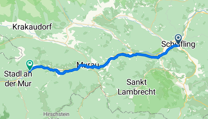
Murradweg linkes Ufer: Sankt Lorenzen bei Knittelfeld – Sankt Lorenzen bei Scheifling
Cycling route in Sankt Lorenzen bei Knittelfeld, Styria, Austria
- 56.1 km
- Distance
- 612 m
- Ascent
- 447 m
- Descent
Murradweg linkes Ufer – Abs. 2: St. Ruprecht-Falkendorf → Sankt Lorenzen bei Scheifling
Cycling route in St. Ruprecht-Falkendorf, Styria, Austria
- 35.9 km
- Distance
- 752 m
- Ascent
- 647 m
- Descent

Murradweg linkes Ufer – Abs. 2: Stadl an der Mur → St. Ruprecht-Falkendorf
Cycling route in Stadl an der Mur, Styria, Austria
- 9.9 km
- Distance
- 166 m
- Ascent
- 106 m
- Descent