
Panorama Bike
Panorama Bike (MTB)
A collection of 24 cycling routes.
Overview
About this collection
Big views, steady climbs, and long, grin‑inducing descents—this collection is all about riding from one panorama to the next. The routes link gravel tracks, forest paths, and quiet roads, with short paved and occasionally busier connectors. Expect mixed surfaces (from smooth asphalt to loose gravel and a few rocky bits), so wider tires and decent brakes are your friends.
You can tackle it as a multi‑day bikepacking journey or pick off single stages for day rides. The terrain rolls through hills, fields, and small villages, with regular chances to grab water and snacks in towns along the way. There’s plenty of elevation, but the views pay you back.
Best for confident riders on a hardtail MTB or a capable gravel bike (40 mm+). Bring layers and tools, pace the climbs, and be courteous on shared paths—there may be hikers, farm vehicles, and livestock. Ride smart, soak up the scenery, and let the panoramas do the talking.
- 24
- Routes
- -:--
- Duration
- 454.5 km
- Distance
- ---
- Avg. speed
- 17,681 m
- Ascent
- 17,777 m
- Descent
Panorama Bike (MTB)
Routes in this collection
All 24 routes in this collection can be opened on the map or in the Bikemap App for more details, where you can adjust them in the route planner, or download them as GPX or KML file. Use them as a template for planning your own rides, or let Bikemap navigate you along them directly.

Panorama Bike - Étape 14
Cycling route in Le Châtelard, Canton of Vaud, Switzerland
- 25.7 km
- Distance
- 1,828 m
- Ascent
- 1,325 m
- Descent

Panorama Bike - Étape 13
Cycling route in Gruyères, Canton of Fribourg, Switzerland
- 52.4 km
- Distance
- 1,676 m
- Ascent
- 1,951 m
- Descent
Panorama Bike - Étape 12
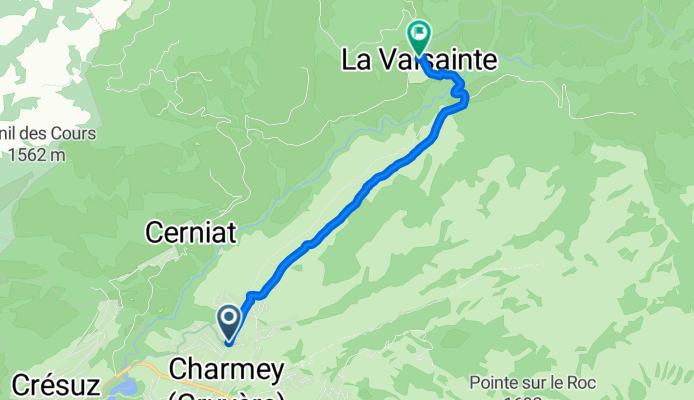
Cycling route in Charmey, Canton of Fribourg, Switzerland
- 4.5 km
- Distance
- 206 m
- Ascent
- 78 m
- Descent

Panorama Bike - Étape 12: Charmey to Oberschrot
Cycling route in Charmey, Canton of Fribourg, Switzerland
- 9.8 km
- Distance
- 471 m
- Ascent
- 452 m
- Descent

Panorama Bike – Etappe 11: Plaffeien – Oberschrot
Cycling route in Plaffeien, Canton of Fribourg, Switzerland
- 6.4 km
- Distance
- 40 m
- Ascent
- 215 m
- Descent

Panorama Bike - Etappe 11
Cycling route in Plaffeien, Canton of Fribourg, Switzerland
- 2.4 km
- Distance
- 361 m
- Ascent
- 36 m
- Descent

Panorama Bike - Stage 11: Guggisberg to Blumenstein
Cycling route in Guggisberg, Canton of Bern, Switzerland
- 18.9 km
- Distance
- 418 m
- Ascent
- 1,161 m
- Descent

Panorama Bike - Stage 11: Blumenstein to Thun
Cycling route in Blumenstein, Canton of Bern, Switzerland
- 14.8 km
- Distance
- 121 m
- Ascent
- 337 m
- Descent

Panorama Bike – Etappe 10: Thun to Ringgenberg
Cycling route in Thun, Canton of Bern, Switzerland
- 46.7 km
- Distance
- 2,198 m
- Ascent
- 1,651 m
- Descent

Panorama Bike Stage 09: Brienz to Ringgenberg
Cycling route in Brienz, Canton of Bern, Switzerland
- 28.9 km
- Distance
- 1,401 m
- Ascent
- 871 m
- Descent

Panorama Bike - Etappe 08
Cycling route in Flühli, Canton of Lucerne, Switzerland
- 18.8 km
- Distance
- 657 m
- Ascent
- 1,231 m
- Descent

Panorama Bike - Etappe 08
Cycling route in Giswil, Canton of Obwalden, Switzerland
- 11.4 km
- Distance
- 143 m
- Ascent
- 247 m
- Descent