
Franconian Water Cycle Route
Fränkischer WasserRadweg
A collection of 17 cycling routes.
Overview
About this collection
Long-distance bike tour through Franconia – always close to water: rivers, canals and lakes. You mostly ride on asphalt and quiet roads, plus many farm tracks and paths; there are also noticeable gravel sections and some cobblestones. The route is mostly gently hilly with occasional waves. Ideal for trekking or gravel bikes; doable with luggage, also comfortable in stages.
Typically on the way: wide river valleys, quiet shores, Franconian villages and lots of landscape. Sections along the canal are relaxed and family-friendly, while the field and forest paths bring more of a nature feel. You can choose start points flexibly along the route and plan the tour as day stages or multi-day.
Tip: Bring lights and puncture-resistant tires – there are longer sections off main roads.
- 17
- Routes
- -:--
- Duration
- 434.4 km
- Distance
- ---
- Avg. speed
- 3,715 m
- Ascent
- 3,681 m
- Descent
Fränkischer WasserRadweg
Routes in this collection
All 17 routes in this collection can be opened on the map or in the Bikemap App for more details, where you can adjust them in the route planner, or download them as GPX or KML file. Use them as a template for planning your own rides, or let Bikemap navigate you along them directly.

Fränkischer WasserRadweg – Etappe 7: Ansbach – Roth
Cycling route in Ansbach, Bavaria, Germany
- 48.8 km
- Distance
- 545 m
- Ascent
- 485 m
- Descent

Fränkischer WasserRadweg - Etappe 7
Cycling route in Ansbach, Bavaria, Germany
- 3.6 km
- Distance
- 11 m
- Ascent
- 10 m
- Descent

Fränkischer WasserRadweg Etappe 6: Diebach – Ansbach
Cycling route in Diebach, Bavaria, Germany
- 52.7 km
- Distance
- 395 m
- Ascent
- 412 m
- Descent

Fränkischer WasserRadweg - Etappe 6
Cycling route in Schillingsfürst, Bavaria, Germany
- 8 km
- Distance
- 160 m
- Ascent
- 29 m
- Descent

Fränkischer WasserRadweg – Etappe 5: Schillingsfürst → Dombühl
Cycling route in Schillingsfürst, Bavaria, Germany
- 6.3 km
- Distance
- 48 m
- Ascent
- 101 m
- Descent

Fränkischer WasserRadweg – Etappe 5: Dombühl nach Wassertrüdingen
Cycling route in Dombühl, Bavaria, Germany
- 55.4 km
- Distance
- 293 m
- Ascent
- 342 m
- Descent

Fränkischer WasserRadweg - Etappe 4
Cycling route in Absberg, Bavaria, Germany
- 37.5 km
- Distance
- 304 m
- Ascent
- 309 m
- Descent
Fränkischer WasserRadweg - Etappe 4
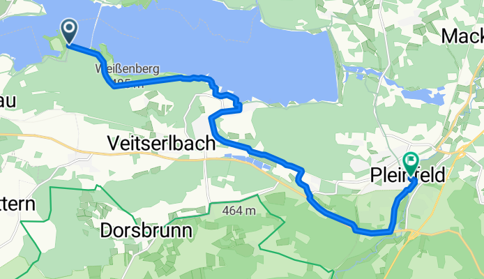
Cycling route in Pleinfeld, Bavaria, Germany
- 11.9 km
- Distance
- 131 m
- Ascent
- 174 m
- Descent

Fränkischer WasserRadweg – Etappe 3: Pleinfeld nach Greding
Cycling route in Pleinfeld, Bavaria, Germany
- 41.8 km
- Distance
- 479 m
- Ascent
- 497 m
- Descent

Fränkischer WasserRadweg – Etappe 2: Greding – Berching
Cycling route in Greding, Bavaria, Germany
- 30.3 km
- Distance
- 228 m
- Ascent
- 233 m
- Descent

Fränkischer WasserRadweg - Etappe 2
Cycling route in Berching, Bavaria, Germany
- 21.4 km
- Distance
- 83 m
- Ascent
- 43 m
- Descent

Fränkischer WasserRadweg - Etappe 1
Cycling route in Allersberg, Bavaria, Germany
- 27.9 km
- Distance
- 164 m
- Ascent
- 203 m
- Descent