
National Cycle Route 1
Nasjonal sykkelrute 1 – Kystruta (Norge)
A collection of 70 cycling routes.
Overview
About this collection
The Kystruta connects coastal towns and islands from south to west, with ferries, bridges, and nice bike paths. This collection covers stages you can cycle separately or link together for a longer tour. Expect mostly asphalt and dedicated bike lanes, some gravel here and there, and a few short sections on busier roads.
Highlights? Sea views, beaches and rocky shores, small harbours and cafés, and fjord crossings that make the trip varied. Many places have train and bus for easy logistics, and ferries are a natural part of the experience. The route is also part of the Nordsjøruta/EuroVelo 12.
Suitable for touring and bikepacking; child-friendly on the quietest parts near towns and villages. Best season is May to September. Weather can change quickly along the coast – bring wind and rain gear. Check local rules for tunnels and any detours before you go.
Choose a short, pleasant day ride along the coast, or link several stages for a proper coastal classic.
- 70
- Routes
- -:--
- Duration
- 5,089.3 km
- Distance
- ---
- Avg. speed
- 73,308 m
- Ascent
- 72,936 m
- Descent
Nasjonal sykkelrute 1 – Kystruta (Norge)
Routes in this collection
All 70 routes in this collection can be opened on the map or in the Bikemap App for more details, where you can adjust them in the route planner, or download them as GPX or KML file. Use them as a template for planning your own rides, or let Bikemap navigate you along them directly.

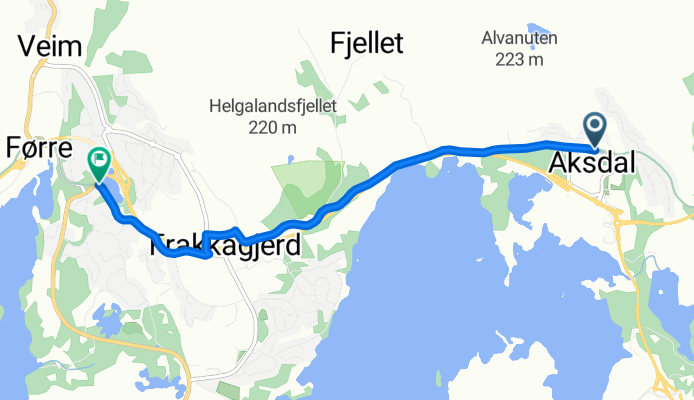
Nasjonal sykkelrute 1: Aksdal–Judaberg
Cycling route in Aksdal, Rogaland, Norway
- 38.5 km
- Distance
- 633 m
- Ascent
- 593 m
- Descent
Nasjonal sykkelrute 1: Eike – Aksdal
Cycling route in Eike, Rogaland, Norway
- 3.7 km
- Distance
- 62 m
- Ascent
- 61 m
- Descent
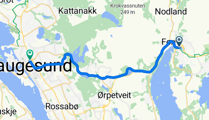
Nasjonal sykkelrute 1: Eike – Haugesund
Cycling route in Eike, Rogaland, Norway
- 9.4 km
- Distance
- 188 m
- Ascent
- 202 m
- Descent

Nasjonal sykkelrute 1: Haugesund–Fitjar
Cycling route in Haugesund, Rogaland, Norway
- 110.8 km
- Distance
- 1,662 m
- Ascent
- 1,676 m
- Descent

Nasjonal sykkelrute 1: Fitjar–Bergen
Cycling route in Fitjar, Hordaland, Norway
- 69.1 km
- Distance
- 795 m
- Ascent
- 795 m
- Descent
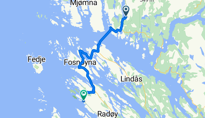
Nasjonal sykkelrute 1: Eivindvik–Manger
Cycling route in Eivindvik, Sogn og Fjordane, Norway
- 41.5 km
- Distance
- 270 m
- Ascent
- 271 m
- Descent

Nasjonal sykkelrute 1 (Bergen–Trondheim): Hyllestad – Eivindvik
Cycling route in Hyllestad, Sogn og Fjordane, Norway
- 68.6 km
- Distance
- 1,587 m
- Ascent
- 1,617 m
- Descent

Nasjonal sykkelrute 1: Askvoll – Hyllestad
Cycling route in Askvoll, Sogn og Fjordane, Norway
- 40.3 km
- Distance
- 735 m
- Ascent
- 693 m
- Descent

Nasjonal sykkelrute 1: Naustdal–Askvoll
Cycling route in Naustdal, Sogn og Fjordane, Norway
- 73.9 km
- Distance
- 2,028 m
- Ascent
- 2,032 m
- Descent

Nasjonal sykkelrute 1: Måløy–Naustdal
Cycling route in Måløy, Sogn og Fjordane, Norway
- 105.1 km
- Distance
- 1,478 m
- Ascent
- 1,473 m
- Descent

Nasjonal sykkelrute 1: Larsnes–Måløy
Cycling route in Larsnes, Møre og Romsdal, Norway
- 94.5 km
- Distance
- 2,673 m
- Ascent
- 2,790 m
- Descent
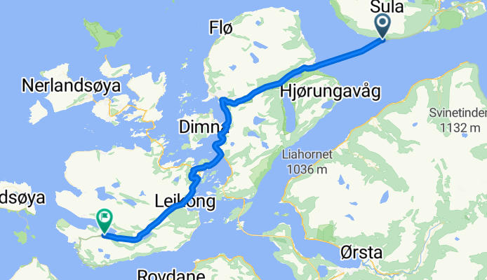
Nasjonal sykkelrute 1: Langevåg–Larsnes
Cycling route in Langevåg, Møre og Romsdal, Norway
- 42.8 km
- Distance
- 713 m
- Ascent
- 588 m
- Descent