
Lake Route
Seen-Route
A collection of 26 cycling routes.
Overview
About this collection
This collection brings together relaxed cycling routes around lakes – including shoreline passages, quiet connecting roads, and a few detours into green areas. Mostly on asphalt, with sections on gravel, dirt and forest paths, and short cobblestone stretches; some parts run along busy roads.
Best suited for touring or gravel bikes; road bikes can manage but some sections are bumpy. Start and finish are flexible: pick a lake, combine route segments, and plan swimming or coffee stops by the water. The terrain is mostly flat to gently rolling, with short climbs depending on the stage.
Tip: Watch for traffic in village sections and where there’s no separate bike path. Ideal for relaxed day trips or a short multi-day tour from lake to lake.
- 26
- Routes
- -:--
- Duration
- 531.3 km
- Distance
- ---
- Avg. speed
- 9,098 m
- Ascent
- 8,665 m
- Descent
Seen-Route
Routes in this collection
All 26 routes in this collection can be opened on the map or in the Bikemap App for more details, where you can adjust them in the route planner, or download them as GPX or KML file. Use them as a template for planning your own rides, or let Bikemap navigate you along them directly.

Seen-Route – Etappe 10: Gaißau → Rorschach
Cycling route in Gaißau, Vorarlberg, Austria
- 16.2 km
- Distance
- 46 m
- Ascent
- 55 m
- Descent

Seen-Route Etappe 10: Fußach – Gaißau
Cycling route in Fußach, Vorarlberg, Austria
- 7.3 km
- Distance
- 8 m
- Ascent
- 10 m
- Descent
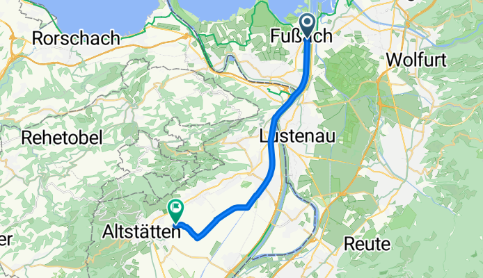
Seen-Route Etappe 10: Altstätten – Fußach
Cycling route in Altstätten, Canton of St. Gallen, Switzerland
- 15.9 km
- Distance
- 28 m
- Ascent
- 7 m
- Descent

Seen-Route Stage 10: Altstätten to Buchs
Cycling route in Altstätten, Canton of St. Gallen, Switzerland
- 31.1 km
- Distance
- 149 m
- Ascent
- 143 m
- Descent

Seen-Route – Etappe 9: Sargans–Buchs
Cycling route in Sargans, Canton of St. Gallen, Switzerland
- 19.2 km
- Distance
- 63 m
- Ascent
- 28 m
- Descent

Seen-Route - Etappe 9
Cycling route in Sargans, Canton of St. Gallen, Switzerland
- 8.6 km
- Distance
- 102 m
- Ascent
- 148 m
- Descent

Seen-Route - Etappe 9
Cycling route in Flums, Canton of St. Gallen, Switzerland
- 26.6 km
- Distance
- 773 m
- Ascent
- 793 m
- Descent

Seen-Route: Schindellegi to Niederurnen
Cycling route in Schindellegi, Canton of Schwyz, Switzerland
- 38.4 km
- Distance
- 519 m
- Ascent
- 167 m
- Descent

Seen-Route: Einsiedeln to Schindellegi
Cycling route in Einsiedeln, Canton of Schwyz, Switzerland
- 14 km
- Distance
- 376 m
- Ascent
- 264 m
- Descent

Seen-Route - Etappe 7
Cycling route in Schindellegi, Canton of Schwyz, Switzerland
- 40.8 km
- Distance
- 478 m
- Ascent
- 891 m
- Descent

Seen-Route - Etappe 6: Root nach Zug
Cycling route in Root, Canton of Lucerne, Switzerland
- 12.9 km
- Distance
- 75 m
- Ascent
- 55 m
- Descent

Seen-Route – Etappe 6: Root–Inwil
Cycling route in Root, Canton of Lucerne, Switzerland
- 3.1 km
- Distance
- 4 m
- Ascent
- 12 m
- Descent