
The Great Tour of the Prealps of the Azure Coast
Grand Tour des Préalpes d'Azur à vélo
A collection of 8 cycling routes.
Overview
About this collection
A challenging large loop between the Mediterranean and the Alps, in the heart of the Préalpes d’Azur Regional Natural Park. On the menu: long mountain passes, balcony roads, limestone gorges, and perched villages, with views that can stretch to the sea on clear days.
The profile is tough, with lots of elevation and sustained descents — perfect for trained cyclists or bikepacking mode. The route is mostly on roads, and some sections can be busy: start early, use lights, and stay visible.
Free departure (modular circuit) and direction of your choice: break the route into stages according to your legs and desires. You can find water and supplies in villages, but some sections are quite wild, so plan for autonomy.
Best seasons: spring and autumn for mildness and calm. In summer, it can be very hot on the lower slopes; in winter, watch out for cold and possible snow at altitude.
To sum up: a mountain–sea crossing full of character, from the garrigue to the plateaus, ideal for those who love long climbs, limestone landscapes, and the scent of adventure, while staying on the road.
- 8
- Routes
- -:--
- Duration
- 250.1 km
- Distance
- ---
- Avg. speed
- 10,957 m
- Ascent
- 10,623 m
- Descent
Grand Tour des Préalpes d'Azur à vélo
Routes in this collection
All 8 routes in this collection can be opened on the map or in the Bikemap App for more details, where you can adjust them in the route planner, or download them as GPX or KML file. Use them as a template for planning your own rides, or let Bikemap navigate you along them directly.

Le Grand Tour des Préalpes d'Azur - Étape 1: Grasse à Saint-Vallier-de-Thiey
Cycling route in Grasse, Provence-Alpes-Côte d'Azur Region, France
- 24.2 km
- Distance
- 444 m
- Ascent
- 777 m
- Descent

Le Grand Tour des Préalpes d'Azur - Etape 6
Cycling route in Grasse, Provence-Alpes-Côte d'Azur Region, France
- 6.1 km
- Distance
- 185 m
- Ascent
- 101 m
- Descent

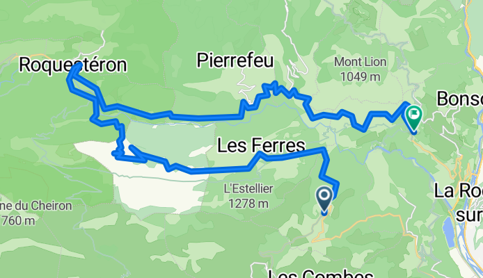
Le Grand Tour des Préalpes d’Azur – Étape 6: Opio → Gilette
Cycling route in Opio, Provence-Alpes-Côte d'Azur Region, France
- 39.8 km
- Distance
- 1,761 m
- Ascent
- 1,531 m
- Descent
Le Grand Tour des Préalpes d'Azur - Etape 5
Cycling route in Gilette, Provence-Alpes-Côte d'Azur Region, France
- 40.8 km
- Distance
- 2,180 m
- Ascent
- 2,357 m
- Descent

Le Grand Tour des Préalpes d'Azur - Etape 4
Cycling route in Puget-Théniers, Provence-Alpes-Côte d'Azur Region, France
- 35.3 km
- Distance
- 2,083 m
- Ascent
- 1,928 m
- Descent

Le Grand Tour des Préalpes d'Azur - Etape 4
Cycling route in Puget-Théniers, Provence-Alpes-Côte d'Azur Region, France
- 14.8 km
- Distance
- 834 m
- Ascent
- 877 m
- Descent

Le Grand Tour des Préalpes d'Azur - Etape 3
Cycling route in Saint-Vallier-de-Thiey, Provence-Alpes-Côte d'Azur Region, France
- 50.3 km
- Distance
- 2,368 m
- Ascent
- 1,732 m
- Descent

Le Grand Tour des Préalpes d'Azur - Etape 2
Cycling route in Saint-Vallier-de-Thiey, Provence-Alpes-Côte d'Azur Region, France
- 38.8 km
- Distance
- 1,104 m
- Ascent
- 1,320 m
- Descent