Stuttgart E-Bike Routes
E-Bike Region Stuttgart

Stuttgart E-Bike Routes

A collection of 12 cycling routes.
OverviewAbout this collection

Explore Stuttgart and its surroundings the easy way—by e‑bike. This collection strings together varied routes through the city bowl and out into the region’s vineyards, river valleys, and forests.

Expect mostly smooth, paved riding with plenty of asphalt cycleways and quiet roads. You’ll also hit some gravel and farm tracks here and there, so wider tires are a plus. The mix ranges from relaxed riverside cruising along the Neckar to short, punchy climbs up to viewpoints—perfect terrain for pedal assist.

Routes pass through lively town centers, leafy parks, and shady woodland, with the occasional link on busier roads—ride defensively and slow down in pedestrian zones. Whether you’re after a mellow coffee spin or a full‑day outing, there’s something that fits, and the e‑assist makes Stuttgart’s hills more fun than tough.

Bring a charged battery, pack a lock, and plan café stops—this is Württemberg wine country, so expect scenic terraces, classic half-timbered streets, and plenty of places to refuel. Enjoy the views and let the motor take the edge off the climbs.

12
Routes
-:--
Duration
396.3 km
Distance
---
Avg. speed
6,676 m
Ascent
6,754 m
Descent
Stuttgart E-Bike RoutesRoutes in this collection
All 12 routes in this collection can be opened on the map or in the Bikemap App for more details, where you can adjust them in the route planner, or download them as GPX or KML file. Use them as a template for planning your own rides, or let Bikemap navigate you along them directly.
E-Bike Region Stuttgart: Schorndorf – Winterbach (Nordost)
Official
E-Bike Region Stuttgart: Schorndorf – Winterbach (Nordost)

Cycling route in Schorndorf, Baden-Wurttemberg, Germany

Short connection in the northeast area of the E-Bike Region Stuttgart from Schorndorf to Winterbach. Around 4 km, almost entirely paved, mostly on farm roads and quiet streets. Hardly any elevation gain – ideal for relaxed riding through the Rems Valley, for everyday trips or as a family-friendly d…
3.9 km
Distance
3 m
Ascent
7 m
Descent
E-Bike Region Stuttgart: Winterbach – Böhmenkirch (Nordost)
Official
E-Bike Region Stuttgart: Winterbach – Böhmenkirch (Nordost)

Cycling route in Winterbach, Baden-Wurttemberg, Germany

From Winterbach head east to Böhmenkirch: about 54 km with nearly 1,400 meters of elevation gain – fairly hilly, ideal for e-bikes. Mostly on asphalt, many quiet side roads and farm tracks, plus short gravel sections. Along the way you'll find lots of greenery, meadows and forests. Start in the Rem…
53.5 km
Distance
1,395 m
Ascent
988 m
Descent
E-Bike Region Stuttgart: Böhmenkirch – Geislingen an der Steige (Nordost)
Official
E-Bike Region Stuttgart: Böhmenkirch – Geislingen an der Steige (Nordost)

Cycling route in Böhmenkirch, Baden-Wurttemberg, Germany

Short tour in the northeast of the Stuttgart E‑Bike region: from Böhmenkirch downhill on the Alb to Geislingen an der Steige. About 14 km, with significantly more descent than ascent – ideal for relaxed riding. The surface is mostly paved, with sections on paths and gravel. Watch out for a few shor…
14.3 km
Distance
160 m
Ascent
376 m
Descent
E-Bike Region Stuttgart Südost: Geislingen an der Steige – Bad Überkingen
Official
E-Bike Region Stuttgart Südost: Geislingen an der Steige – Bad Überkingen

Cycling route in Geislingen an der Steige, Baden-Wurttemberg, Germany

Short connection on the Albtrauf: from Geislingen an der Steige to Bad Überkingen. About 5.3 km, mostly asphalt and cycle paths, gently rolling with few elevation changes. Start in the Fils valley, finish in the spa town of Bad Überkingen with mineral springs. Ideal as a relaxed short route or fami…
5.4 km
Distance
49 m
Ascent
30 m
Descent
E-Bike Region Stuttgart Südost: Bad Überkingen – Kohlberg
Official
E-Bike Region Stuttgart Südost: Bad Überkingen – Kohlberg

Cycling route in Bad Ăśberkingen, Baden-Wurttemberg, Germany

From Bad Überkingen to Kohlberg through the southeastern part of the Stuttgart E-Bike Region. About 49 km and around 950 meters of elevation gain – sporty but relaxed with an E-Bike. Mostly paved, quiet paths and farm roads, occasionally gravel. Starting at the spa town of Bad Überkingen on the Alb…
48.6 km
Distance
949 m
Ascent
944 m
Descent
E-Bike Region Stuttgart – Südost: Kohlberg nach Nürtingen
Official
E-Bike Region Stuttgart – Südost: Kohlberg nach Nürtingen

Cycling route in Kohlberg, Baden-Wurttemberg, Germany

Short and relaxed from Kohlberg to Nürtingen: around 10.6 km, gentle descent with about 80 m ascent and much more descent. You mostly ride on asphalt and quiet side roads as well as country paths – ideal for e-bike beginners. From the Swabian Alb foothills, you head into the Neckar valley, with nic…
10.7 km
Distance
83 m
Ascent
268 m
Descent
E-Bike Region Stuttgart: Leonberg to NĂĽrtingen
Official
E-Bike Region Stuttgart: Leonberg to NĂĽrtingen

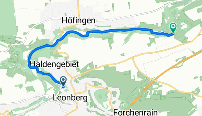
Cycling route in Leonberg, Baden-Wurttemberg, Germany

Head out from Leonberg toward Nürtingen on an 86 km ride with about 1,180 m of climbing. It's a mix of quiet roads and plenty of forest tracks and gravel, so wider tires and an e-bike boost shine here. Enjoy Leonberg's historic center before rolling through rural hills toward the Neckar. Finish in …
85.9 km
Distance
1,179 m
Ascent
1,093 m
Descent
E-Bike Region Stuttgart: Gerlingen to Leonberg
Official
E-Bike Region Stuttgart: Gerlingen to Leonberg

Cycling route in Gerlingen, Baden-Wurttemberg, Germany

A short hop in the E-Bike Region Stuttgart from Gerlingen to Leonberg. Mostly paved with a brief gravel bit, it rolls gently with more downhill than up. You’ll follow quiet access roads and paths between two neighboring towns—starting just outside Stuttgart and finishing in Leonberg (Böblingen dist…
4.8 km
Distance
53 m
Ascent
94 m
Descent
E-Bike Region Stuttgart: Ditzingen to Benningen am Neckar
Official
E-Bike Region Stuttgart: Ditzingen to Benningen am Neckar

Cycling route in Ditzingen, Baden-Wurttemberg, Germany

Roll out from Ditzingen and weave through the Ludwigsburg countryside to the Neckar. About 59 km with roughly 650 m of climbing, mostly on paved tracks and quiet roads, plus a few short gravel bits. Expect farmland, villages, and vineyard views before you drop into Benningen am Neckar, a riverside …
59.2 km
Distance
653 m
Ascent
759 m
Descent
E-Bike-Region Stuttgart: Lorch - Erdmannhausen (Nordost)
Official
E-Bike-Region Stuttgart: Lorch - Erdmannhausen (Nordost)

Cycling route in Lorch, Baden-Wurttemberg, Germany

Challenging northeast stage of the Stuttgart E-Bike region from Lorch to Erdmannhausen. Starting at Lorch Abbey, then on quiet roads and paths through the Rems valley and over the hills of the Welzheim forest, with many elevation meters. Mostly asphalt, short gravel sections. Beautiful views of vin…
96.2 km
Distance
2,022 m
Ascent
1,985 m
Descent
E-Bike Region Stuttgart: PlĂĽderhausen to Lorch
Official
E-Bike Region Stuttgart: PlĂĽderhausen to Lorch

Cycling route in PlĂĽderhausen, Baden-Wurttemberg, Germany

A short, easy spin from Plüderhausen to Lorch through the Rems valley. It’s mostly paved with a few brief gravel bits, rolling gently downhill overall—great for a relaxed outing or an e-bike cruise. Expect quiet roads and farm tracks across about 8 km. Start by the Rems in Plüderhausen and finish i…
8.2 km
Distance
92 m
Ascent
164 m
Descent
E-Bike-Region Stuttgart (Nordost): Schorndorf – Plüderhausen
Official
E-Bike-Region Stuttgart (Nordost): Schorndorf – Plüderhausen

Cycling route in Schorndorf, Baden-Wurttemberg, Germany

Short, relaxed connection from Schorndorf to Plüderhausen in the Stuttgart e-bike region (northeast). Start in Schorndorf, hometown of Gottlieb Daimler, then an easy ride through the Rems valley. About 5.5 km, almost no elevation, mostly asphalt on quiet roads and paths. Ideal for warming up or as …
5.5 km
Distance
38 m
Ascent
48 m
Descent