
Bad Laasphe - Tolmin
A cycling tour with 11 stages, starting in Bad Laasphe, North Rhine-Westphalia, Germany.
Overview
About this tour
This cycling tour has 11 stages and a total length of 1,106.8 km.
- 11
- Routes
- 65 h 48 min
- Duration
- 1,106.8 km
- Distance
- 16.8 km/h
- Avg. speed
- 11,949 m
- Ascent
- 12,073 m
- Descent
created this 5 months ago
Bad Laasphe - Tolmin
Stages of this tour
All 11 stages of this tour can be opened on the map or in the Bikemap App for more details, where you can adjust them in the route planner or download them as GPX or KML file. Use them as a template for planning your own tour, or let Bikemap navigate you along them directly.
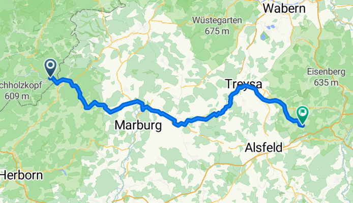
Bad Laasphe - Ottrau
Cycling route in Bad Laasphe, North Rhine-Westphalia, Germany
- 104.8 km
- Distance
- 803 m
- Ascent
- 774 m
- Descent
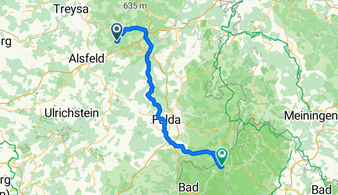
Ottrau - Bischofsheim an der Rhön
Cycling route in Ottrau, Hesse, Germany
- 100 km
- Distance
- 1,111 m
- Ascent
- 860 m
- Descent
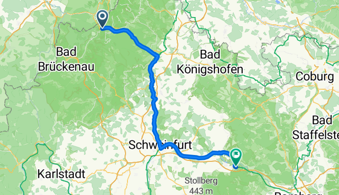
Bischofsheim an der Rhön - Sand
Cycling route in Bischofsheim in der Rhön, Bavaria, Germany
- 94.5 km
- Distance
- 433 m
- Ascent
- 793 m
- Descent
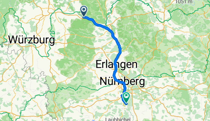
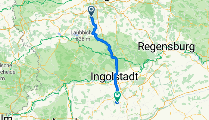
Rednitzhembach - Pfaffenhofen an der Ilm
Cycling route in Rednitzhembach, Bavaria, Germany
- 111 km
- Distance
- 1,067 m
- Ascent
- 947 m
- Descent
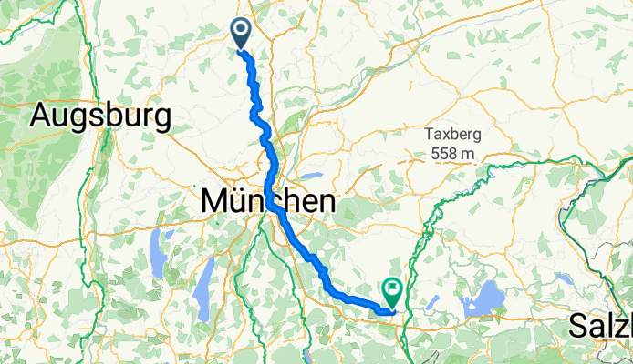
Pfaffenhofen an der Ilm - Kolbermoor
Cycling route in Pfaffenhofen an der Ilm, Bavaria, Germany
- 123.6 km
- Distance
- 785 m
- Ascent
- 805 m
- Descent
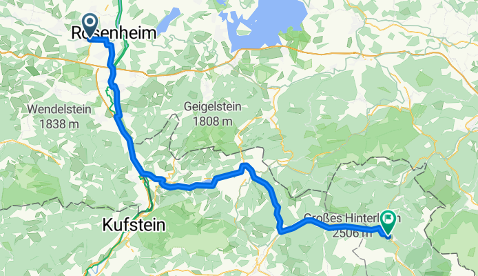
Kolbermoor - Sankt Martin bei Lofer
Cycling route in Kolbermoor, Bavaria, Germany
- 82.9 km
- Distance
- 1,227 m
- Ascent
- 1,056 m
- Descent
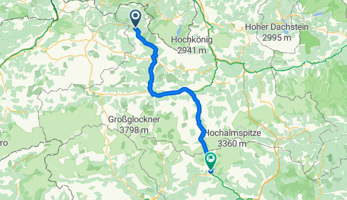
Sankt Martin bei Lofer - Obervellach
Cycling route in Sankt Martin bei Lofer, Salzburg, Austria
- 110.7 km
- Distance
- 1,923 m
- Ascent
- 1,635 m
- Descent
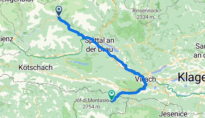
Obervellach - Tarvisio
Cycling route in Obervellach, Carinthia, Austria
- 106.8 km
- Distance
- 1,461 m
- Ascent
- 1,643 m
- Descent
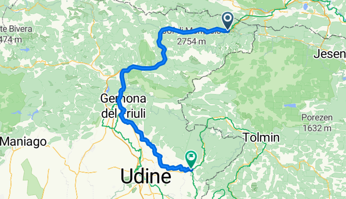
Tarvisio - Cividale
Cycling route in Tarvisio, Friuli Venezia Giulia, Italy
- 110.5 km
- Distance
- 1,057 m
- Ascent
- 1,661 m
- Descent
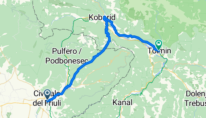
Cividale - Tolmin
Cycling route in Cividale del Friuli, Friuli Venezia Giulia, Italy
- 44.6 km
- Distance
- 1,228 m
- Ascent
- 1,163 m
- Descent