
Treptow - Eixample
A cycling tour with 18 stages, starting in Kreuzberg, State of Berlin, Germany.
Overview
About this tour
This cycling tour has 18 stages and a total length of 2,066.6 km.
- 18
- Routes
- 122 h 43 min
- Duration
- 2,066.6 km
- Distance
- 16.8 km/h
- Avg. speed
- 2,177 m
- Ascent
- 2,177 m
- Descent
created this 7 months ago
Treptow - Eixample
Stages of this tour
All 18 stages of this tour can be opened on the map or in the Bikemap App for more details, where you can adjust them in the route planner or download them as GPX or KML file. Use them as a template for planning your own tour, or let Bikemap navigate you along them directly.
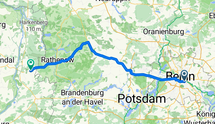
Treptow - Schönhausen
Cycling route in Kreuzberg, State of Berlin, Germany
- 107.6 km
- Distance
- 21 m
- Ascent
- 5 m
- Descent
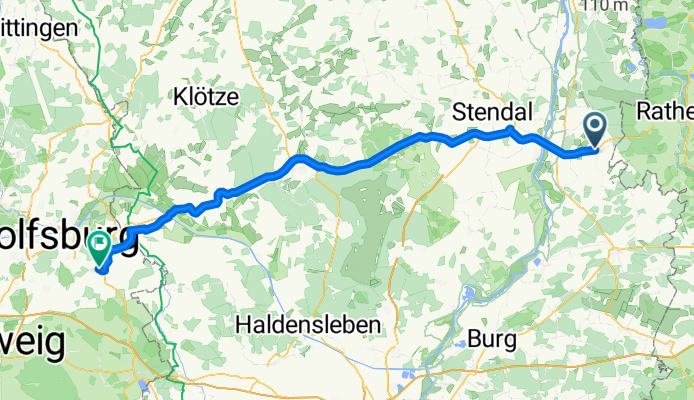
Schönhausen - Groß Twülpstedt
Cycling route in Schönhausen, Saxony-Anhalt, Germany
- 98.4 km
- Distance
- 42 m
- Ascent
- 15 m
- Descent
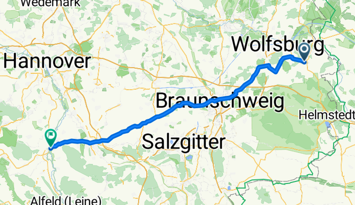
Groß Twülpstedt - Elze
Cycling route in Groß Twülpstedt, Lower Saxony, Germany
- 94 km
- Distance
- 9 m
- Ascent
- 5 m
- Descent
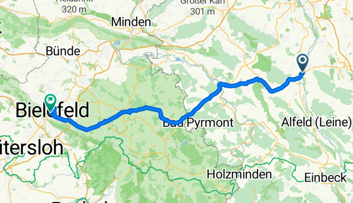
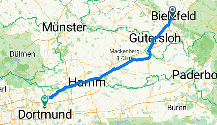
Bielefeld - Dortmund
Cycling route in Bielefeld, North Rhine-Westphalia, Germany
- 101.9 km
- Distance
- 44 m
- Ascent
- 74 m
- Descent
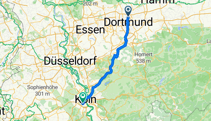
Dortmund - Neustadt/Süd
Cycling route in Dortmund, North Rhine-Westphalia, Germany
- 99 km
- Distance
- 210 m
- Ascent
- 186 m
- Descent
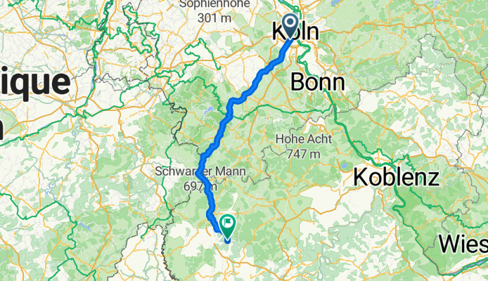
Neustadt/Süd - Balesfeld
Cycling route in Neustadt/Süd, North Rhine-Westphalia, Germany
- 125.9 km
- Distance
- 554 m
- Ascent
- 252 m
- Descent
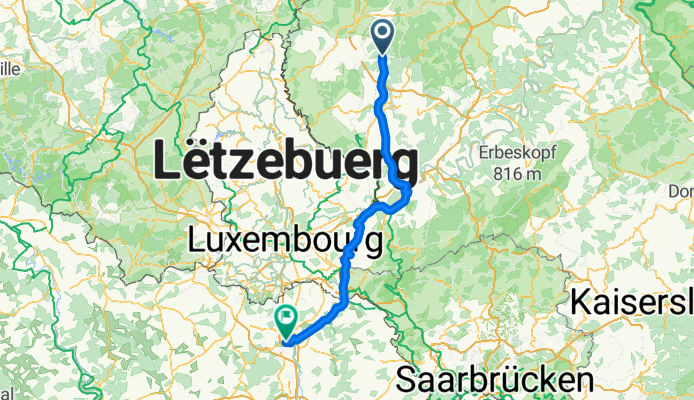
Balesfeld - Terville
Cycling route in Balesfeld, Rhineland-Palatinate, Germany
- 118.8 km
- Distance
- 65 m
- Ascent
- 289 m
- Descent
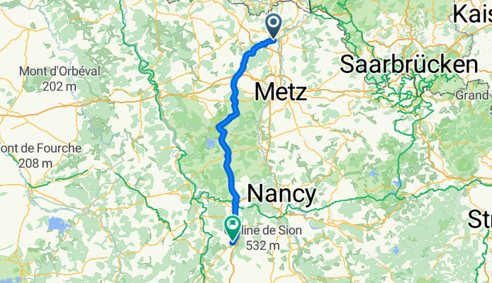
Terville - Colombey-les-Belles
Cycling route in Terville, Grand Est, France
- 120.2 km
- Distance
- 86 m
- Ascent
- 32 m
- Descent
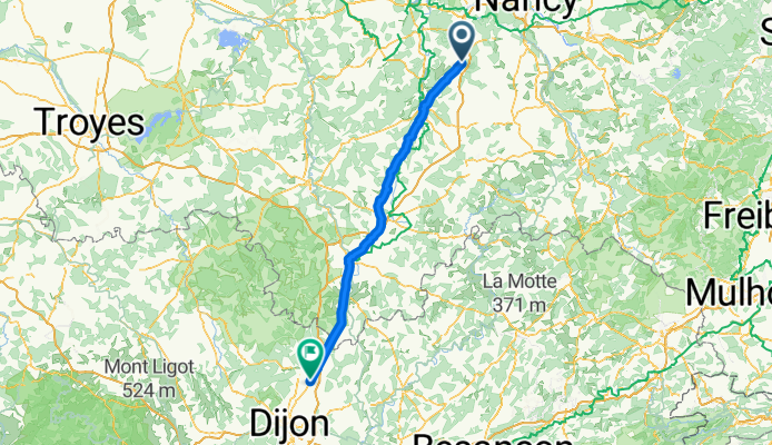
Colombey-les-Belles - Marcilly-sur-Tille
Cycling route in Colombey-les-Belles, Grand Est, France
- 138.4 km
- Distance
- 214 m
- Ascent
- 174 m
- Descent
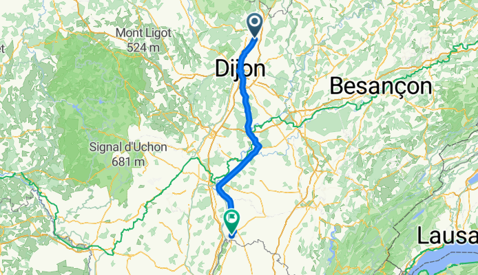
Marcilly-sur-Tille - Cuisery
Cycling route in Marcilly-sur-Tille, Bourgogne-Franche-Comté, France
- 126.7 km
- Distance
- 7 m
- Ascent
- 103 m
- Descent
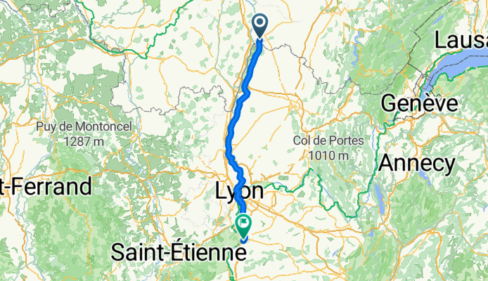
Cuisery - Vienne
Cycling route in Cuisery, Bourgogne-Franche-Comté, France
- 134 km
- Distance
- 0 m
- Ascent
- 38 m
- Descent