
Kańcza
A cycling tour with 4 stages, starting in Kańczuga, Subcarpathian Voivodeship, Poland.
Overview
About this tour
This cycling tour has 4 stages and a total length of 160.8 km.
- 4
- Routes
- -:--
- Duration
- 160.8 km
- Distance
- ---
- Avg. speed
- 1,502 m
- Ascent
- 1,495 m
- Descent
Kasiaczek

created this 4 months ago
Kańcza
Stages of this tour
All 4 stages of this tour can be opened on the map or in the Bikemap App for more details, where you can adjust them in the route planner or download them as GPX or KML file. Use them as a template for planning your own tour, or let Bikemap navigate you along them directly.

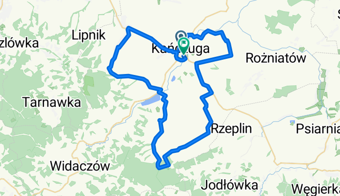
#4 GSR POiB IIWŚ
Cycling route in Kańczuga, Subcarpathian Voivodeship, Poland
Gminny Szlak Rowerowy Pamieci Ofiar i Bohaterów II WŚ.
Pierwsze 8 km ze wzgledu na dwa odcinki dróg dedykowane dla rowerów MTB,cross,treking.
(1).od 0,5 do 2 km szlaku od startu, droga polna miejscami lekko utwardzona
(2). od 4 do 8 km drog…
- 35.1 km
- Distance
- 367 m
- Ascent
- 360 m
- Descent
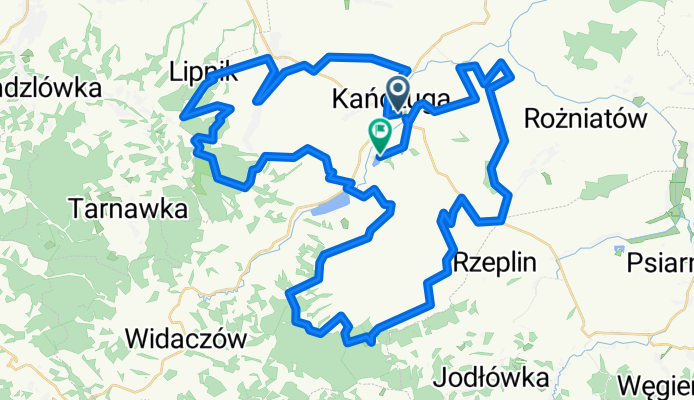
69 km GSR "Max" Kańczucka Pętla
Cycling route in Kańczuga, Subcarpathian Voivodeship, Poland
Całość ok.70 km
Szlak podzielony na 5 segmentów o zróżnicowanej trudności które można przejechać osobno/niezależnie (kto nie czuje się na siłach lub z braku czasu nie jest w stanie przejechać całego szlaku za jednym razem może przejechać szlak odcinkami/segmentami) . Każdy se…
- 69 km
- Distance
- 695 m
- Ascent
- 687 m
- Descent

#1 GSR (Familijny)
Cycling route in Kańczuga, Subcarpathian Voivodeship, Poland
Gminny Szlak Rowerowy "Mini" (Familijny)
Start:Stadion/Dom Ludowy Niżatyce.
Meta: Zalew "Łopuszka Mała "
Dystans: 14 km.
Czas Przejazdu: 1h do 1h:30 min
Nawierzchnia: 100% asfalt.
Trasa szlaku łatwa ,odpowiednia dla rodzinnych przejazdów w spo…
- 13.5 km
- Distance
- 60 m
- Ascent
- 60 m
- Descent
# 3 GSR "EDU 9"
Cycling route in Kańczuga, Subcarpathian Voivodeship, Poland
Gminny Szlak Rowerowy „EDU 9”.
Długość: 43,5 km / 98% asfalt - pozostałe 2% to ok.1km leśna,gruntowa droga Rączyna Łopuszka Wlk ( na 20,5 -21,5 km szlaku) . W za…
- 43.2 km
- Distance
- 380 m
- Ascent
- 388 m
- Descent