
From Antibes to Chamonix-Mont-Blanc
A cycling tour with 8 stages, starting in Antibes, Provence-Alpes-Côte d'Azur Region, France.
Overview
About this tour
This cycling tour has 8 stages and a total length of 718.4 km.
- 8
- Routes
- 43 h 9 min
- Duration
- 718.4 km
- Distance
- 16.7 km/h
- Avg. speed
- 8,410 m
- Ascent
- 7,377 m
- Descent
From Antibes to Chamonix-Mont-Blanc
Stages of this tour
All 8 stages of this tour can be opened on the map or in the Bikemap App for more details, where you can adjust them in the route planner or download them as GPX or KML file. Use them as a template for planning your own tour, or let Bikemap navigate you along them directly.
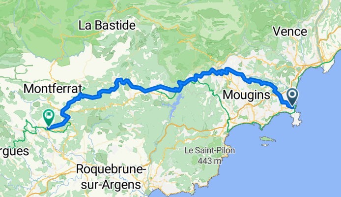
Antibes - Draguignan
Cycling route in Antibes, Provence-Alpes-Côte d'Azur Region, France
- 85.7 km
- Distance
- 2,153 m
- Ascent
- 1,941 m
- Descent
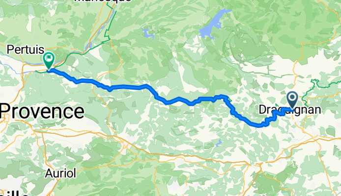
Draguignan - Peyrolles-en-Provence
Cycling route in Draguignan, Provence-Alpes-Côte d'Azur Region, France
- 95.3 km
- Distance
- 1,426 m
- Ascent
- 1,419 m
- Descent
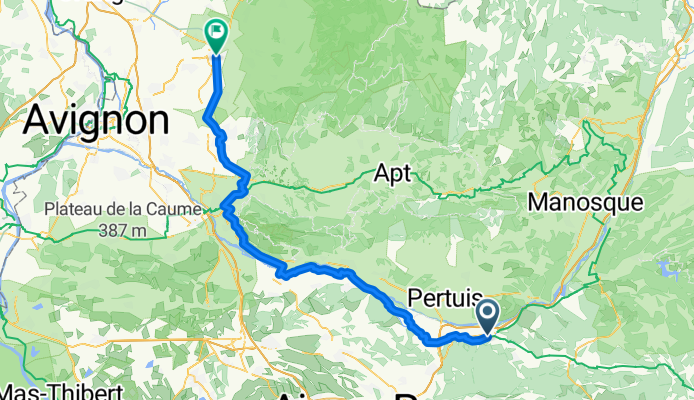
Peyrolles-en-Provence - Carpentras
Cycling route in Peyrolles-en-Provence, Provence-Alpes-Côte d'Azur Region, France
- 93.4 km
- Distance
- 403 m
- Ascent
- 545 m
- Descent
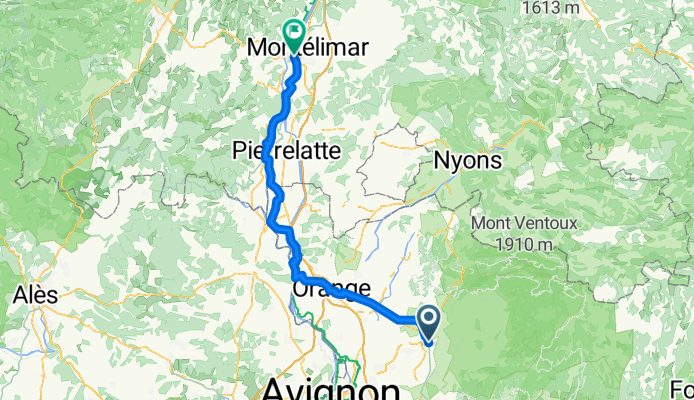
Carpentras - Le Teil
Cycling route in Carpentras, Provence-Alpes-Côte d'Azur Region, France
- 90.8 km
- Distance
- 261 m
- Ascent
- 278 m
- Descent
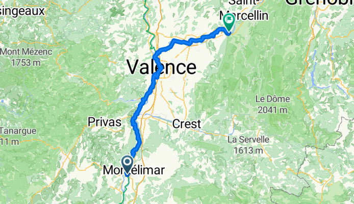
Le Teil - Saint-Just-de-Claix
Cycling route in Le Teil, Auvergne-Rhône-Alpes, France
- 113.6 km
- Distance
- 573 m
- Ascent
- 458 m
- Descent
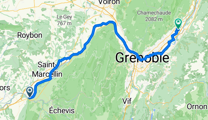
Saint-Just-de-Claix - Crolles
Cycling route in Saint-Just-de-Claix, Auvergne-Rhône-Alpes, France
- 85.9 km
- Distance
- 576 m
- Ascent
- 533 m
- Descent
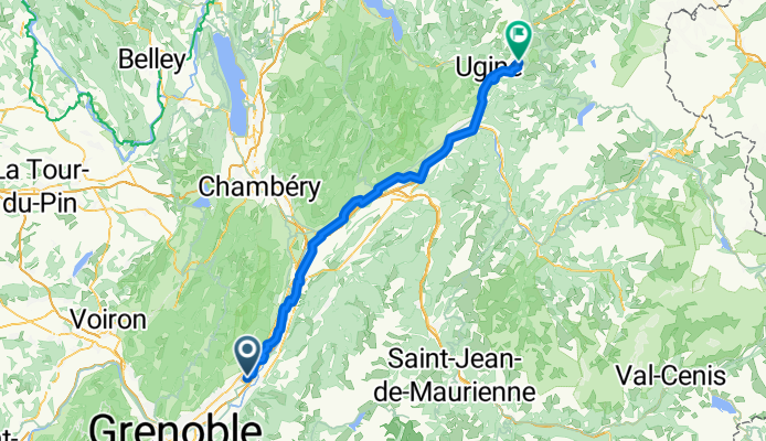
Crolles - Ugine
Cycling route in Crolles, Auvergne-Rhône-Alpes, France
- 91.7 km
- Distance
- 1,195 m
- Ascent
- 485 m
- Descent
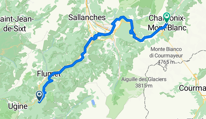
Ugine - Chamonix
Cycling route in Ugine, Auvergne-Rhône-Alpes, France
- 62 km
- Distance
- 1,823 m
- Ascent
- 1,718 m
- Descent