
Briancon
A collection of 12 cycling routes, created by Dieter Witterauf.
Overview
About this collection
This route collection contains 12 cycling routes with a total length of 604.5 km.
- 12
- Routes
- 48 h 52 min
- Duration
- 604.5 km
- Distance
- 12.4 km/h
- Avg. speed
- 22,320 m
- Ascent
- 17,713 m
- Descent

created this 5 months ago
Briancon
Routes in this collection
All 12 routes in this collection can be opened on the map or in the Bikemap App for more details, where you can adjust them in the route planner, or download them as GPX or KML file. Use them as a template for planning your own rides, or let Bikemap navigate you along them directly.
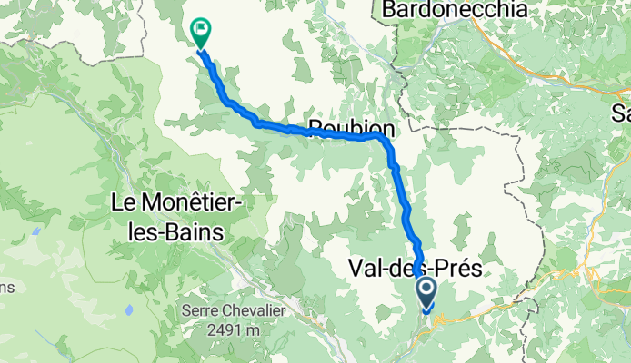
01_Val des Prés - Refuge de Laval 25/700
Cycling route in Briançon, Provence-Alpes-Côte d'Azur Region, France
- 24.4 km
- Distance
- 688 m
- Ascent
- 30 m
- Descent

2_Galibier vom Campingplatz 80/2100
Cycling route in Briançon, Provence-Alpes-Côte d'Azur Region, France
- 80.1 km
- Distance
- 2,033 m
- Ascent
- 2,032 m
- Descent

3_Col d’Izoard vom Campingplatz 105/4500
Cycling route in Briançon, Provence-Alpes-Côte d'Azur Region, France
- 105.6 km
- Distance
- 4,383 m
- Ascent
- 4,381 m
- Descent

4.1 Auf den Balkonen der Durance 50/1300
Cycling route in Guillestre, Provence-Alpes-Côte d'Azur Region, France
- 50.1 km
- Distance
- 1,263 m
- Ascent
- 1,265 m
- Descent

4.2 Balkone Stausee und Durance 55/1850
Cycling route in Guillestre, Provence-Alpes-Côte d'Azur Region, France
- 54.5 km
- Distance
- 1,763 m
- Ascent
- 1,790 m
- Descent

5_Col l'Echelle_Montgenévre 75/2400
Cycling route in Briançon, Provence-Alpes-Côte d'Azur Region, France
- 73.3 km
- Distance
- 2,231 m
- Ascent
- 2,237 m
- Descent

6_Alp d'Huez-Col de Sarenne 50/2400
Cycling route in Mont-de-Lans, Auvergne-Rhône-Alpes, France
- 50 km
- Distance
- 2,253 m
- Ascent
- 2,262 m
- Descent

7_Col Agnel von Guillestre 46/3000
Cycling route in Guillestre, Provence-Alpes-Côte d'Azur Region, France
- 46.1 km
- Distance
- 2,829 m
- Ascent
- 991 m
- Descent

8_Col de Vars vom Bf Mont Dauphin 25/1800
Cycling route in Guillestre, Provence-Alpes-Côte d'Azur Region, France
- 24.1 km
- Distance
- 1,695 m
- Ascent
- 476 m
- Descent

9.1_Zum Bf Mont Dauphin_Nebenstraßen 45/1200
Cycling route in Briançon, Provence-Alpes-Côte d'Azur Region, France
- 44.8 km
- Distance
- 1,151 m
- Ascent
- 1,623 m
- Descent

9.2_N 94_Bf Mont Dauphin zum Camping 40/1000
Cycling route in Guillestre, Provence-Alpes-Côte d'Azur Region, France
- 38.5 km
- Distance
- 941 m
- Ascent
- 467 m
- Descent

Von Mizoën bis Clavans-en-Haut-Oisans
Cycling route in Mont-de-Lans, Auvergne-Rhône-Alpes, France
- 13 km
- Distance
- 1,090 m
- Ascent
- 159 m
- Descent