
Annecy Barcelona
A cycling tour with 15 stages, starting in Sevrier, Auvergne-Rhône-Alpes, France.
Overview
About this tour
This cycling tour has 15 stages and a total length of 960.4 km.
- 15
- Routes
- 58 h 45 min
- Duration
- 960.4 km
- Distance
- 16.3 km/h
- Avg. speed
- 4,750 m
- Ascent
- 5,169 m
- Descent
created this 3 months ago
Annecy Barcelona
Stages of this tour
All 15 stages of this tour can be opened on the map or in the Bikemap App for more details, where you can adjust them in the route planner or download them as GPX or KML file. Use them as a template for planning your own tour, or let Bikemap navigate you along them directly.
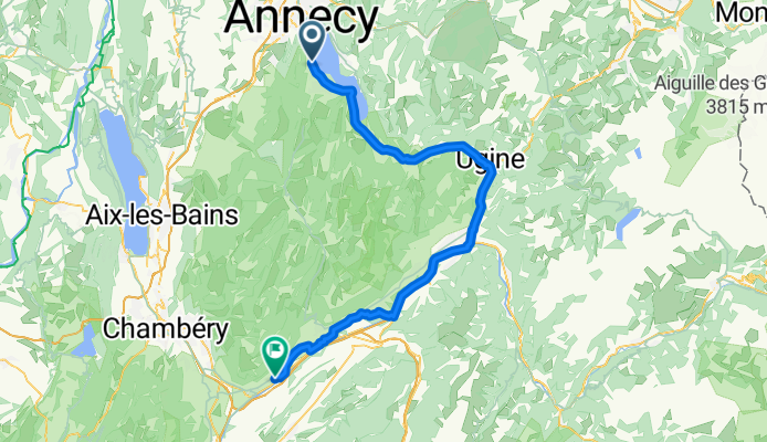
Sévrier - Cruet
Cycling route in Sevrier, Auvergne-Rhône-Alpes, France
- 74.5 km
- Distance
- 211 m
- Ascent
- 397 m
- Descent
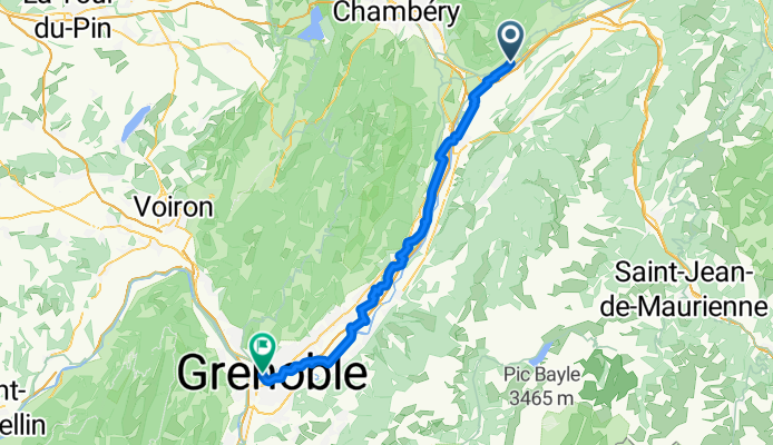
Cruet - Saint-Martin-le-Vinoux
Cycling route in Cruet, Auvergne-Rhône-Alpes, France
- 59.6 km
- Distance
- 160 m
- Ascent
- 206 m
- Descent
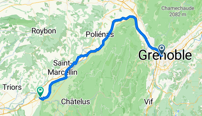
Saint-Martin-le-Vinoux - Saint-Lattier
Cycling route in Saint-Martin-le-Vinoux, Auvergne-Rhône-Alpes, France
- 64.6 km
- Distance
- 490 m
- Ascent
- 521 m
- Descent
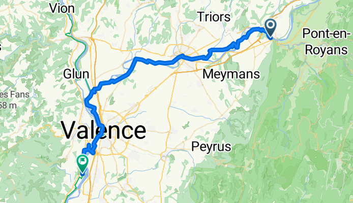
Saint-Lattier - Soyons
Cycling route in Saint-Lattier, Auvergne-Rhône-Alpes, France
- 60.2 km
- Distance
- 219 m
- Ascent
- 302 m
- Descent
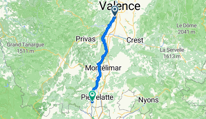
Soyons - Bourg-Saint-Andéol
Cycling route in Soyons, Auvergne-Rhône-Alpes, France
- 78.5 km
- Distance
- 277 m
- Ascent
- 333 m
- Descent
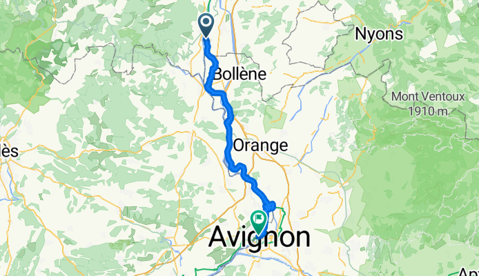
Bourg-Saint-Andéol - Avignon
Cycling route in Bourg-Saint-Andéol, Auvergne-Rhône-Alpes, France
- 65.2 km
- Distance
- 117 m
- Ascent
- 146 m
- Descent
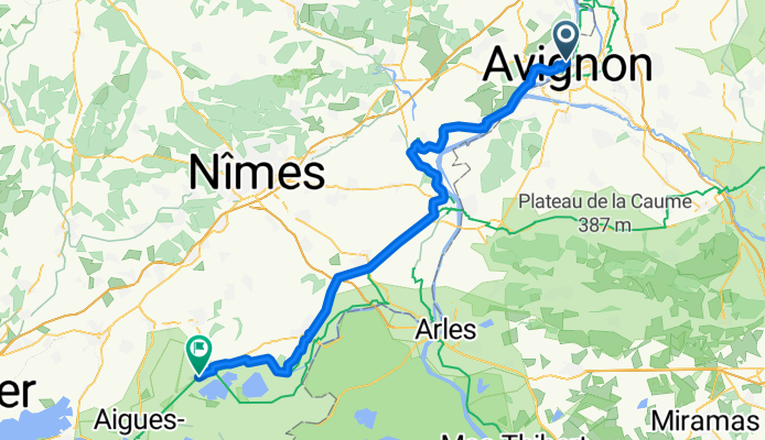
Avignon - Le Cailar
Cycling route in Avignon, Provence-Alpes-Côte d'Azur Region, France
- 75.3 km
- Distance
- 246 m
- Ascent
- 265 m
- Descent
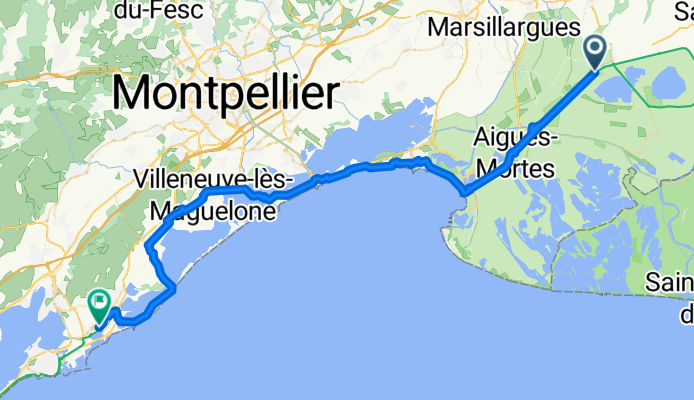
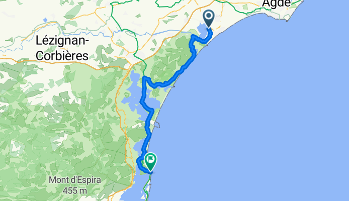
Le Cailar - Frontignan
Cycling route in Le Cailar, Occitanie, France
- 68.5 km
- Distance
- 99 m
- Ascent
- 102 m
- Descent
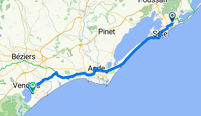
Frontignan - Vendres
Cycling route in Frontignan, Occitanie, France
- 57.8 km
- Distance
- 175 m
- Ascent
- 152 m
- Descent
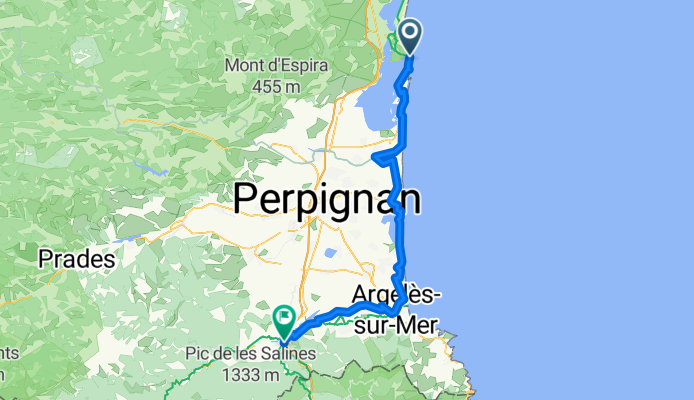
Leucate - Maureillas-las-Illas
Cycling route in Leucate, Occitanie, France
- 77.7 km
- Distance
- 170 m
- Ascent
- 70 m
- Descent
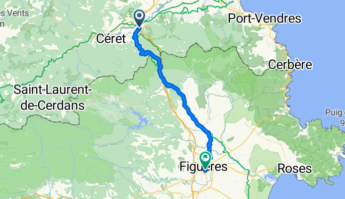
Maureillas-las-Illas - Figueres
Cycling route in Maureillas-las-Illas, Occitanie, France
- 42.3 km
- Distance
- 695 m
- Ascent
- 768 m
- Descent