
Route to Angers
A cycling tour with 19 stages, starting in Mulhouse, Grand Est, France.
Overview
About this tour
This cycling tour has 19 stages and a total length of 893.9 km.
- 19
- Routes
- 54 h 26 min
- Duration
- 893.9 km
- Distance
- 16.4 km/h
- Avg. speed
- 4,000 m
- Ascent
- 4,191 m
- Descent

created this 5 months ago
Route to Angers
Stages of this tour
All 19 stages of this tour can be opened on the map or in the Bikemap App for more details, where you can adjust them in the route planner or download them as GPX or KML file. Use them as a template for planning your own tour, or let Bikemap navigate you along them directly.
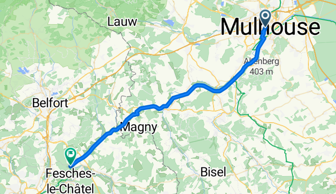
Mulhouse - Bourogne
Cycling route in Mulhouse, Grand Est, France
- 44.4 km
- Distance
- 139 m
- Ascent
- 50 m
- Descent
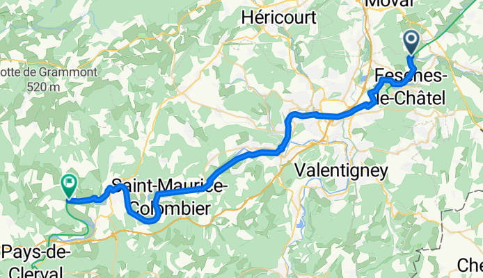
Bourogne - Clerval
Cycling route in Bourogne, Bourgogne-Franche-Comté, France
- 42.2 km
- Distance
- 233 m
- Ascent
- 275 m
- Descent
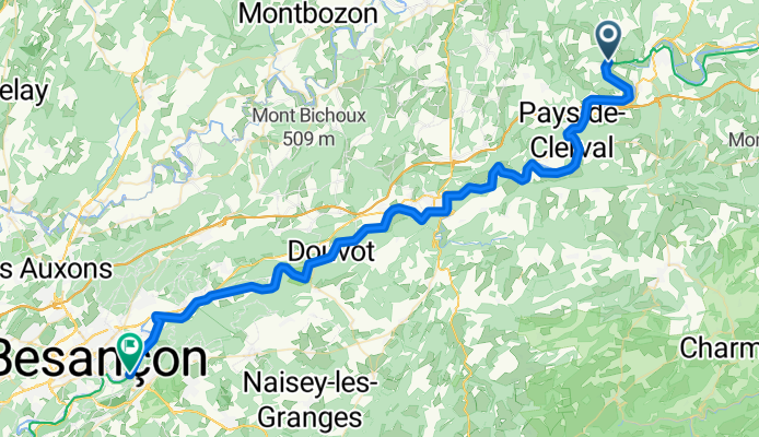
Clerval - Morre
Cycling route in Clerval, Bourgogne-Franche-Comté, France
- 60.5 km
- Distance
- 650 m
- Ascent
- 690 m
- Descent
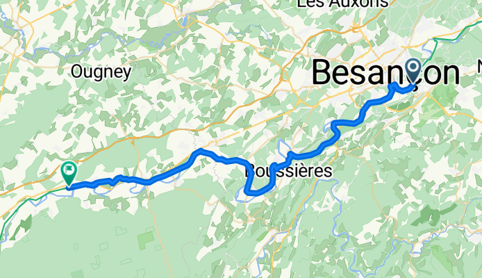
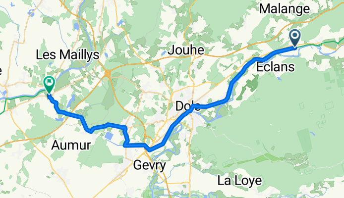
Morre - Orchamps
Cycling route in Morre, Bourgogne-Franche-Comté, France
- 46.5 km
- Distance
- 456 m
- Ascent
- 495 m
- Descent
Orchamps - Saint-Jean-de-Losne
Cycling route in Orchamps, Bourgogne-Franche-Comté, France
- 33.1 km
- Distance
- 80 m
- Ascent
- 103 m
- Descent
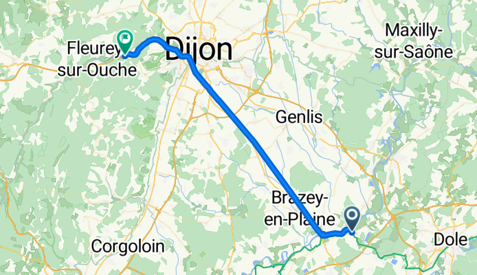
Saint-Jean-de-Losne - Velars-sur-Ouche
Cycling route in Saint-Jean-de-Losne, Bourgogne-Franche-Comté, France
- 46.6 km
- Distance
- 169 m
- Ascent
- 90 m
- Descent
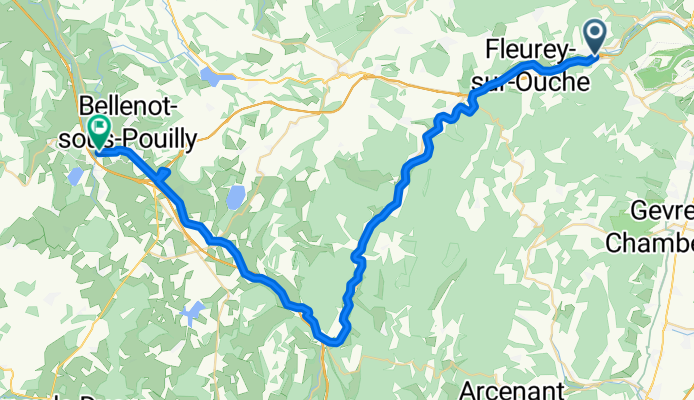
Velars-sur-Ouche - Pouilly-en-Auxois
Cycling route in Velars-sur-Ouche, Bourgogne-Franche-Comté, France
- 50 km
- Distance
- 276 m
- Ascent
- 175 m
- Descent
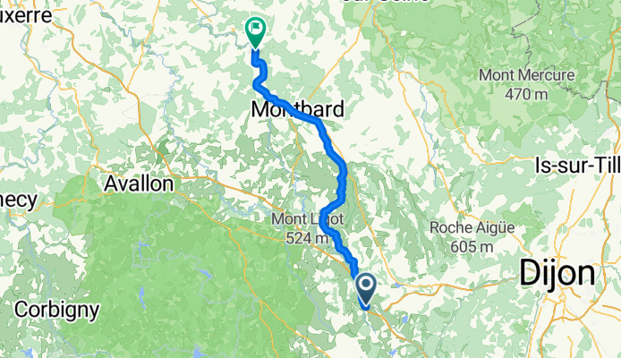
Pouilly-en-Auxois - Ravières
Cycling route in Pouilly-en-Auxois, Bourgogne-Franche-Comté, France
- 71.7 km
- Distance
- 110 m
- Ascent
- 291 m
- Descent
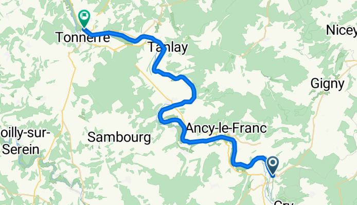
Ravières - Tonnerre
Cycling route in Ravières, Bourgogne-Franche-Comté, France
- 38.6 km
- Distance
- 27 m
- Ascent
- 72 m
- Descent
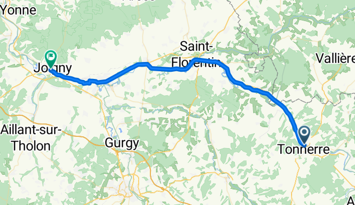
Tonnerre - Joigny
Cycling route in Tonnerre, Bourgogne-Franche-Comté, France
- 53.5 km
- Distance
- 33 m
- Ascent
- 88 m
- Descent
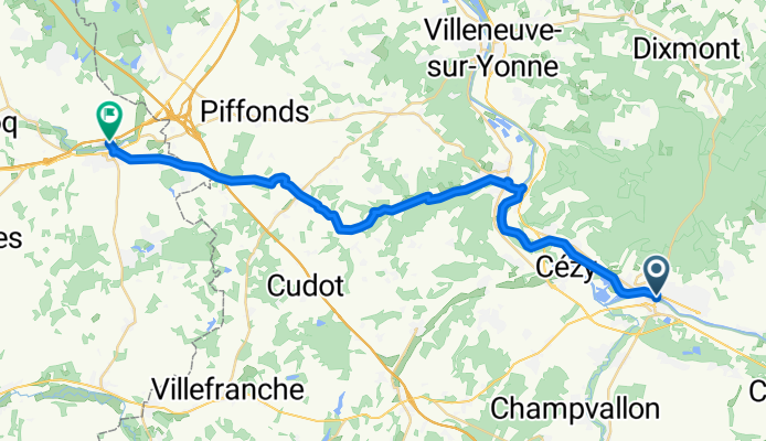
Joigny - Courtenay
Cycling route in Joigny, Bourgogne-Franche-Comté, France
- 33.7 km
- Distance
- 285 m
- Ascent
- 215 m
- Descent
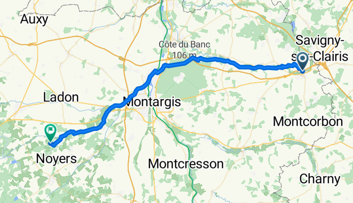
Courtenay - Lorris
Cycling route in Courtenay, Centre-Val de Loire, France
- 51.2 km
- Distance
- 252 m
- Ascent
- 294 m
- Descent