
From Ouistreham to Nice
A cycling tour with 12 stages, starting in Ouistreham, Normandy, France.
Overview
About this tour
This cycling tour has 12 stages and a total length of 1,334.2 km.
- 12
- Routes
- 81 h 13 min
- Duration
- 1,334.2 km
- Distance
- 16.4 km/h
- Avg. speed
- 9,603 m
- Ascent
- 9,599 m
- Descent

created this 4 months ago
From Ouistreham to Nice
Stages of this tour
All 12 stages of this tour can be opened on the map or in the Bikemap App for more details, where you can adjust them in the route planner or download them as GPX or KML file. Use them as a template for planning your own tour, or let Bikemap navigate you along them directly.
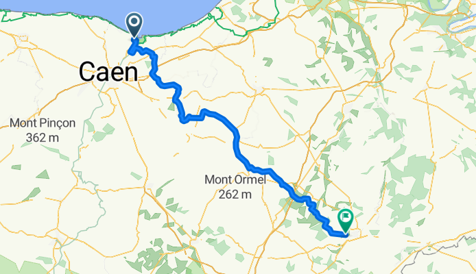
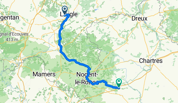
Ouistreham - Rai
Cycling route in Ouistreham, Normandy, France
- 118.9 km
- Distance
- 854 m
- Ascent
- 624 m
- Descent
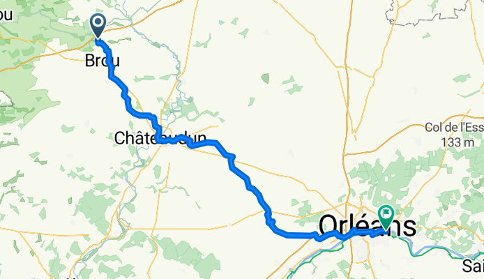
Brou - Saint-Jean-de-Braye
Cycling route in Brou, Centre-Val de Loire, France
- 100.9 km
- Distance
- 201 m
- Ascent
- 285 m
- Descent
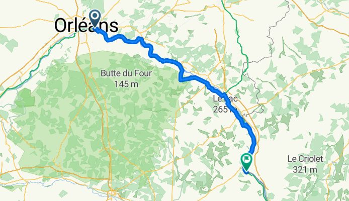
Saint-Jean-de-Braye - Sancerre
Cycling route in Saint-Jean-de-Braye, Centre-Val de Loire, France
- 129.9 km
- Distance
- 394 m
- Ascent
- 346 m
- Descent
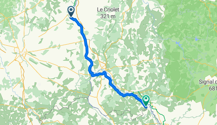
Sancerre - Lucenay-lès-Aix
Cycling route in Sancerre, Centre-Val de Loire, France
- 108.7 km
- Distance
- 153 m
- Ascent
- 99 m
- Descent
Lucenay-lès-Aix - Le Coteau
Cycling route in Lucenay-lès-Aix, Bourgogne-Franche-Comté, France
- 125.7 km
- Distance
- 290 m
- Ascent
- 211 m
- Descent
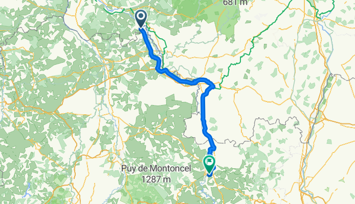
Le Coteau - Les Roches-de-Condrieu
Cycling route in Le Coteau, Auvergne-Rhône-Alpes, France
- 117.2 km
- Distance
- 2,314 m
- Ascent
- 2,450 m
- Descent
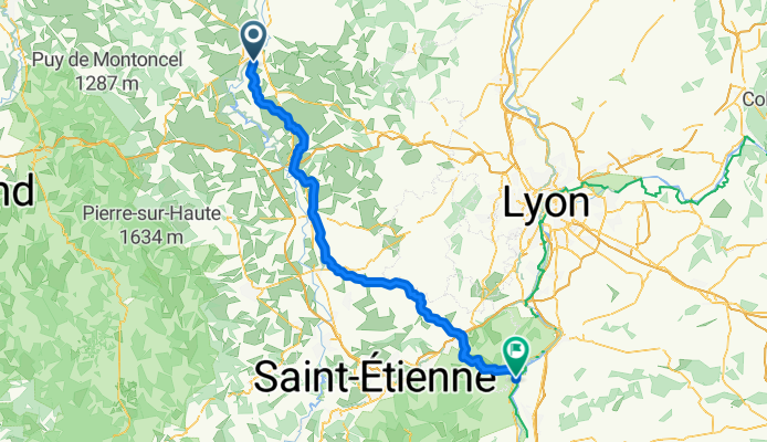
Les Roches-de-Condrieu - Le Teil
Cycling route in Les Roches-de-Condrieu, Auvergne-Rhône-Alpes, France
- 138.3 km
- Distance
- 414 m
- Ascent
- 480 m
- Descent
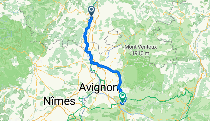
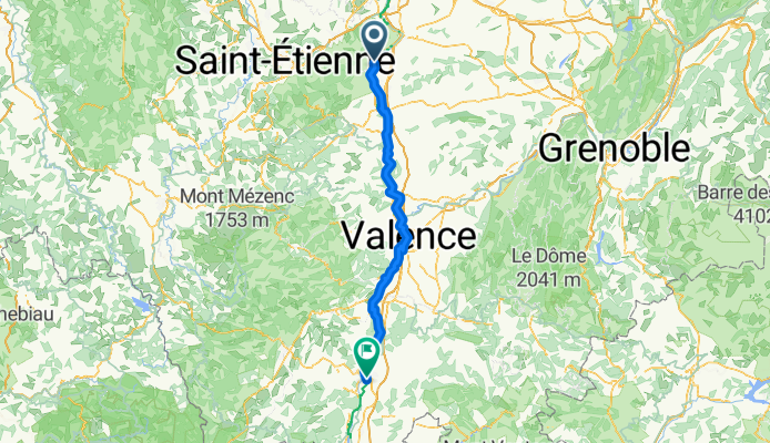
Le Teil - Taillades
Cycling route in Le Teil, Auvergne-Rhône-Alpes, France
- 121.8 km
- Distance
- 354 m
- Ascent
- 348 m
- Descent
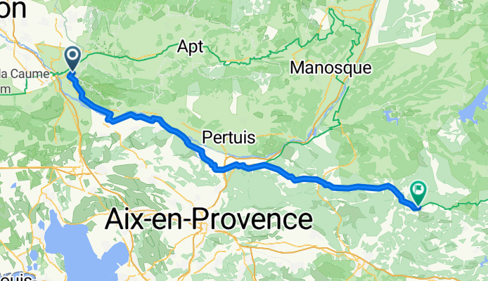
Taillades - Barjols
Cycling route in Taillades, Provence-Alpes-Côte d'Azur Region, France
- 102.9 km
- Distance
- 1,065 m
- Ascent
- 798 m
- Descent
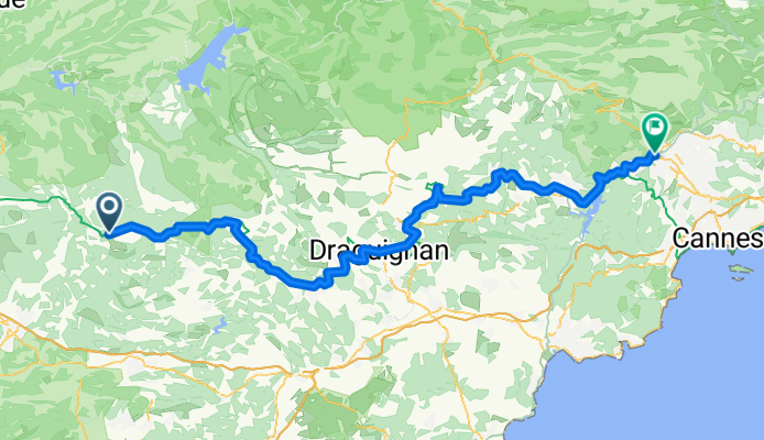
Barjols - Grasse
Cycling route in Barjols, Provence-Alpes-Côte d'Azur Region, France
- 113.2 km
- Distance
- 1,987 m
- Ascent
- 2,082 m
- Descent

Grasse - Nice
Cycling route in Grasse, Provence-Alpes-Côte d'Azur Region, France
- 43.9 km
- Distance
- 601 m
- Ascent
- 834 m
- Descent