
velo81
A cycling tour with 12 stages, starting in Perpignan, Occitanie, France.
Overview
About this tour
This cycling tour has 12 stages and a total length of 588.5 km.
- 12
- Routes
- 37 h 35 min
- Duration
- 588.5 km
- Distance
- 15.7 km/h
- Avg. speed
- 7,204 m
- Ascent
- 7,231 m
- Descent
created this 5 months ago
velo81
Stages of this tour
All 12 stages of this tour can be opened on the map or in the Bikemap App for more details, where you can adjust them in the route planner or download them as GPX or KML file. Use them as a template for planning your own tour, or let Bikemap navigate you along them directly.
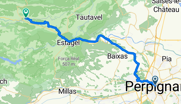
Perpignan - Saint-Paul-de-Fenouillet
Cycling route in Perpignan, Occitanie, France
- 37 km
- Distance
- 370 m
- Ascent
- 230 m
- Descent
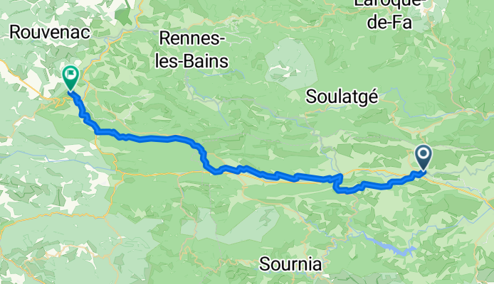
Saint-Paul-de-Fenouillet - Quillan
Cycling route in Saint-Paul-de-Fenouillet, Occitanie, France
- 49 km
- Distance
- 1,713 m
- Ascent
- 1,448 m
- Descent
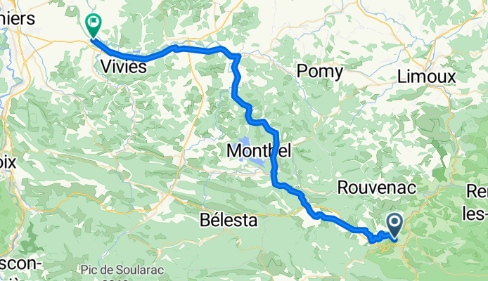
Quillan - La Tour-du-Crieu
Cycling route in Quillan, Occitanie, France
- 58.4 km
- Distance
- 677 m
- Ascent
- 838 m
- Descent
La Tour-du-Crieu - Montjoie-en-Couserans
Cycling route in La Tour-du-Crieu, Occitanie, France
- 41 km
- Distance
- 452 m
- Ascent
- 345 m
- Descent
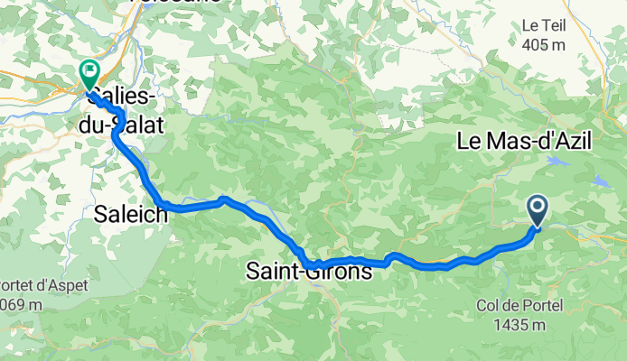
Montjoie-en-Couserans - Salies-du-Salat
Cycling route in Montjoie-en-Couserans, Occitanie, France
- 49.4 km
- Distance
- 515 m
- Ascent
- 576 m
- Descent
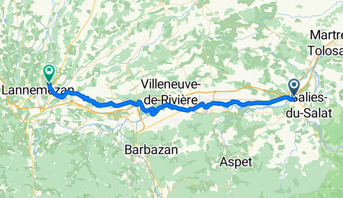
Salies-du-Salat - Lannemezan
Cycling route in Salies-du-Salat, Occitanie, France
- 53.5 km
- Distance
- 470 m
- Ascent
- 212 m
- Descent
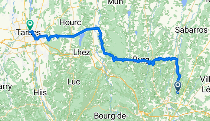
Lannemezan - Tarbes
Cycling route in Lannemezan, Occitanie, France
- 46.1 km
- Distance
- 706 m
- Ascent
- 979 m
- Descent
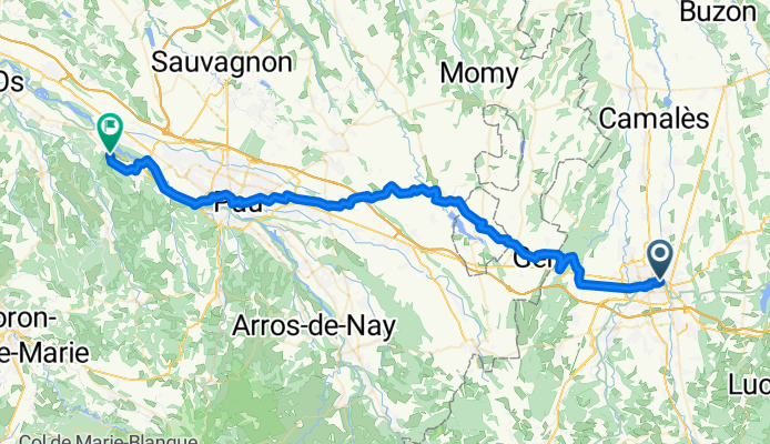
Arbus - Salies-de-Béarn
Cycling route in Arbus, Nouvelle-Aquitaine, France
- 55.1 km
- Distance
- 414 m
- Ascent
- 501 m
- Descent
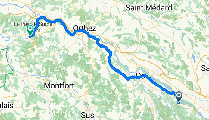
Salies-de-Béarn - Bayonne
Cycling route in Salies-de-Béarn, Nouvelle-Aquitaine, France
- 65.2 km
- Distance
- 470 m
- Ascent
- 513 m
- Descent
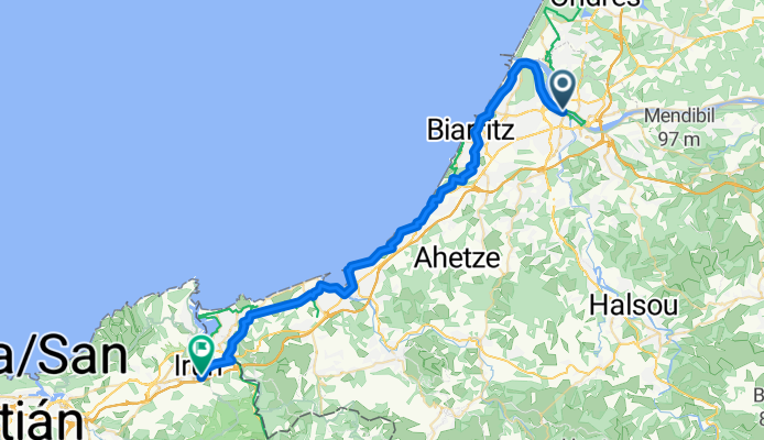
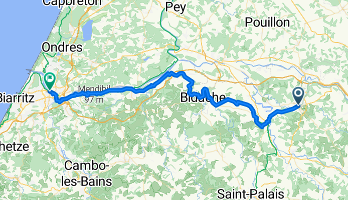
Bayonne - Irun
Cycling route in Bayonne, Nouvelle-Aquitaine, France
- 45.2 km
- Distance
- 634 m
- Ascent
- 630 m
- Descent
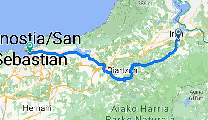
Irun - Donostia / San Sebastián
Cycling route in Irun, Basque Country, Spain
- 22.9 km
- Distance
- 418 m
- Ascent
- 424 m
- Descent