
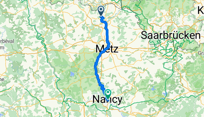
Von Diedenhofen bis Madecourt
A cycling tour with 13 stages, starting in Entrange, Grand Est, France.OverviewAbout this tour
This cycling tour has 13 stages and a total length of
1,296.2 km.
- 13
- Routes
- 75 h 42 min
- Duration
- 1,296.2 km
- Distance
- 17.1 km/h
- Avg. speed
- 7,461 m
- Ascent
- 7,317 m
- Descent
Thomascreated this 5 months ago
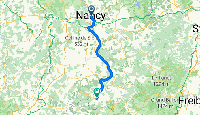
Nancy - Bains-les-Bains
Cycling route in Nancy, Grand Est, France
- 106.4 km
- Distance
- 467 m
- Ascent
- 372 m
- Descent
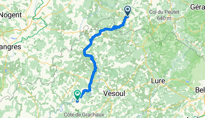
Bains-les-Bains - Scey-sur-Saone-et-Saint-Albin
Cycling route in Bains-les-Bains, Grand Est, France
- 83.8 km
- Distance
- 736 m
- Ascent
- 823 m
- Descent
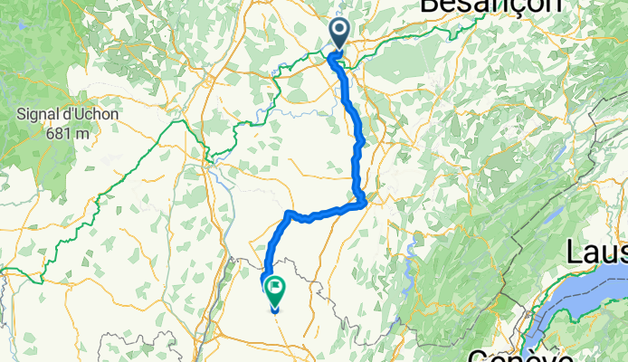
Scey-sur-Saone-et-Saint-Albin - Champvans
Cycling route in Scey-sur-Saône-et-Saint-Albin, Bourgogne-Franche-Comté, France
- 100.2 km
- Distance
- 307 m
- Ascent
- 311 m
- Descent
Champvans - Montrevel-en-Bresse
Cycling route in Champvans, Bourgogne-Franche-Comté, France
- 124.6 km
- Distance
- 513 m
- Ascent
- 516 m
- Descent
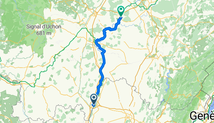
Montrevel-en-Bresse - Montalieu
Cycling route in Montrevel-en-Bresse, Auvergne-Rhône-Alpes, France
- 84.9 km
- Distance
- 441 m
- Ascent
- 429 m
- Descent
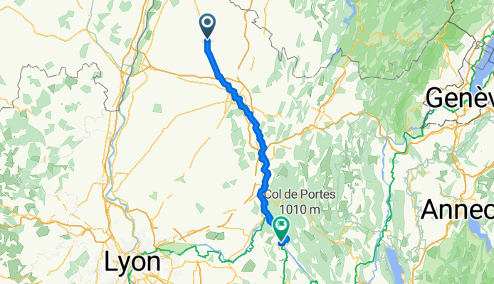
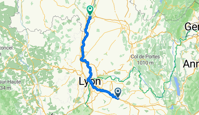
Montalieu - Saint-Martin-le-Vinoux
Cycling route in Montalieu, Auvergne-Rhône-Alpes, France
- 98.7 km
- Distance
- 1,107 m
- Ascent
- 1,097 m
- Descent
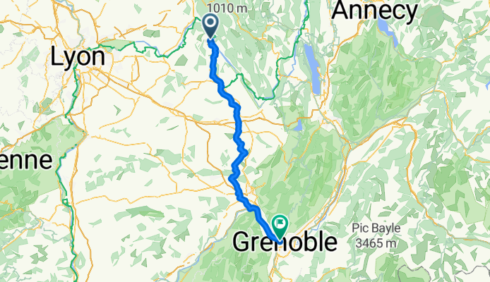
Saint-Martin-le-Vinoux - La Verpillière
Cycling route in Saint-Martin-le-Vinoux, Auvergne-Rhône-Alpes, France
- 86.7 km
- Distance
- 1,222 m
- Ascent
- 1,216 m
- Descent
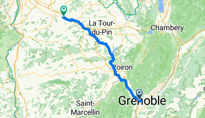
La Verpillière - Mâcon
Cycling route in La Verpillière, Auvergne-Rhône-Alpes, France
- 116.5 km
- Distance
- 409 m
- Ascent
- 459 m
- Descent
Mâcon - Seurre
Cycling route in Mâcon, Bourgogne-Franche-Comté, France
- 112.5 km
- Distance
- 263 m
- Ascent
- 255 m
- Descent
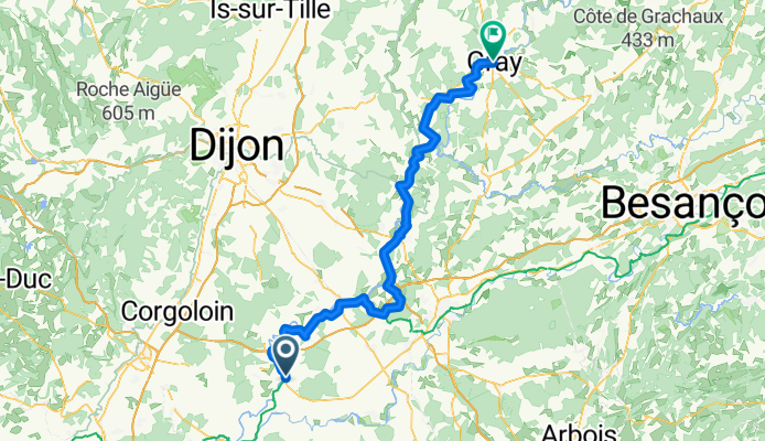
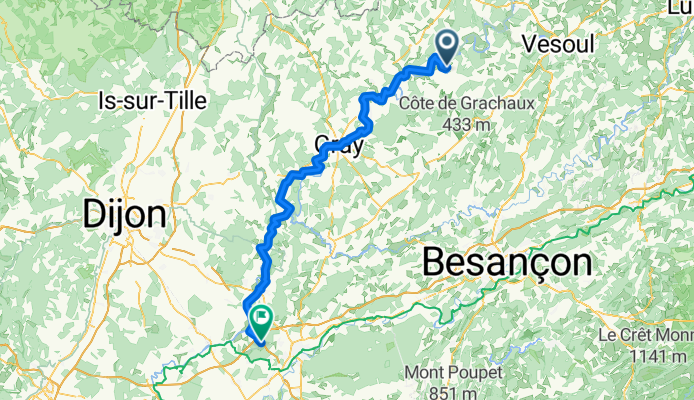
Seurre - Gray
Cycling route in Seurre, Bourgogne-Franche-Comté, France
- 98 km
- Distance
- 222 m
- Ascent
- 206 m
- Descent
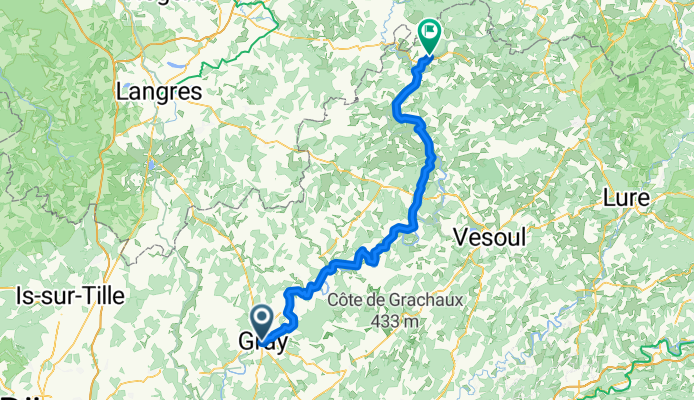
Gray - Jussey
Cycling route in Gray, Bourgogne-Franche-Comté, France
- 96.1 km
- Distance
- 720 m
- Ascent
- 690 m
- Descent