
12957253-BRM 600 MAXI - 12957253-BRM 600 "MAXI 8800"
A cycling tour with 13 stages, starting in Kingersheim, Grand Est, France.
Overview
About this tour
This cycling tour has 13 stages and a total length of 614.3 km.
- 13
- Routes
- 43 h 2 min
- Duration
- 614.3 km
- Distance
- 14.3 km/h
- Avg. speed
- 11,546 m
- Ascent
- 11,542 m
- Descent
created this 18 days ago
12957253-BRM 600 MAXI - 12957253-BRM 600 "MAXI 8800"
Stages of this tour
All 13 stages of this tour can be opened on the map or in the Bikemap App for more details, where you can adjust them in the route planner or download them as GPX or KML file. Use them as a template for planning your own tour, or let Bikemap navigate you along them directly.

Kingersheim - Pfirt
Cycling route in Kingersheim, Grand Est, France
- 77.3 km
- Distance
- 552 m
- Ascent
- 335 m
- Descent

Courfaivre - Tavannes
Cycling route in Courfaivre, Canton of Jura, Switzerland
- 33.7 km
- Distance
- 1,236 m
- Ascent
- 1,048 m
- Descent

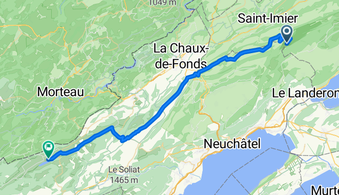
Tavannes - Sankt Immer
Cycling route in Tavannes, Canton of Bern, Switzerland
- 36 km
- Distance
- 1,382 m
- Ascent
- 700 m
- Descent
Sankt Immer - Couvet
Cycling route in Saint-Imier, Canton of Bern, Switzerland
- 48.8 km
- Distance
- 707 m
- Ascent
- 1,156 m
- Descent

Couvet - Jougne
Cycling route in Couvet, Canton of Neuchâtel, Switzerland
- 53 km
- Distance
- 842 m
- Ascent
- 984 m
- Descent
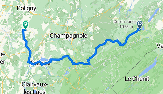
Jougne - Poligny
Cycling route in Jougne, Bourgogne-Franche-Comté, France
- 77.2 km
- Distance
- 943 m
- Ascent
- 1,312 m
- Descent

Poligny - Levier
Cycling route in Poligny, Bourgogne-Franche-Comté, France
- 55.4 km
- Distance
- 685 m
- Ascent
- 585 m
- Descent

Levier - Gilley
Cycling route in Levier, Bourgogne-Franche-Comté, France
- 33 km
- Distance
- 939 m
- Ascent
- 770 m
- Descent
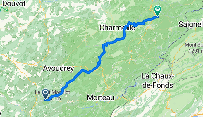
Gilley - Maîche
Cycling route in Gilley, Bourgogne-Franche-Comté, France
- 58.1 km
- Distance
- 1,154 m
- Ascent
- 1,154 m
- Descent

Maîche - Glovelier
Cycling route in Maîche, Bourgogne-Franche-Comté, France
- 43.5 km
- Distance
- 1,321 m
- Ascent
- 1,399 m
- Descent

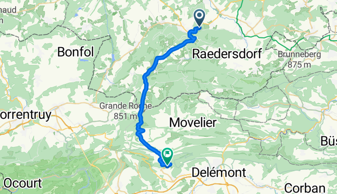
Glovelier - Altkirch
Cycling route in Glovelier, Canton of Jura, Switzerland
- 46.8 km
- Distance
- 984 m
- Ascent
- 1,394 m
- Descent