
From Caen to Saint-Malo
A cycling tour with 13 stages, starting in Caen, Normandy, France.
Overview
About this tour
This cycling tour has 13 stages and a total length of 656.8 km.
- 13
- Routes
- 40 h 34 min
- Duration
- 656.8 km
- Distance
- 16.2 km/h
- Avg. speed
- 3,745 m
- Ascent
- 3,724 m
- Descent

created this 2 months ago
From Caen to Saint-Malo
Stages of this tour
All 13 stages of this tour can be opened on the map or in the Bikemap App for more details, where you can adjust them in the route planner or download them as GPX or KML file. Use them as a template for planning your own tour, or let Bikemap navigate you along them directly.


Clécy - Tessé-la-Madeleine
Cycling route in Clécy, Normandy, France
- 57 km
- Distance
- 763 m
- Ascent
- 659 m
- Descent

Tessé-la-Madeleine - Saint-Denis-sur-Sarthon
Cycling route in Tessé-la-Madeleine, Normandy, France
- 32.7 km
- Distance
- 265 m
- Ascent
- 184 m
- Descent

Saint-Denis-sur-Sarthon - Montbizot
Cycling route in Saint-Denis-sur-Sarthon, Normandy, France
- 64.1 km
- Distance
- 250 m
- Ascent
- 450 m
- Descent

Montbizot - Parigné-le-Pôlin
Cycling route in Montbizot, Pays de la Loire Region, France
- 45.3 km
- Distance
- 251 m
- Ascent
- 245 m
- Descent

Parigné-le-Pôlin - Baugé-en-Anjou
Cycling route in Parigné-le-Pôlin, Pays de la Loire Region, France
- 55.1 km
- Distance
- 261 m
- Ascent
- 283 m
- Descent
Baugé-en-Anjou - La Ménitré
Cycling route in Baugé-en-Anjou, Pays de la Loire Region, France
- 63 km
- Distance
- 394 m
- Ascent
- 398 m
- Descent

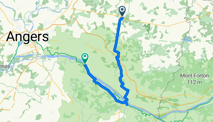
La Ménitré - Avrillé
Cycling route in La Ménitré, Pays de la Loire Region, France
- 36.2 km
- Distance
- 91 m
- Ascent
- 119 m
- Descent

Avrillé - Pouancé
Cycling route in Avrillé, Pays de la Loire Region, France
- 61.2 km
- Distance
- 368 m
- Ascent
- 291 m
- Descent

Pouancé - Argentré-du-Plessis
Cycling route in Pouancé, Pays de la Loire Region, France
- 51.8 km
- Distance
- 263 m
- Ascent
- 268 m
- Descent

Argentré-du-Plessis - Fougères
Cycling route in Argentré-du-Plessis, Brittany Region, France
- 45.7 km
- Distance
- 285 m
- Ascent
- 255 m
- Descent

Fougères - Roz-sur-Couesnon
Cycling route in Fougères, Brittany Region, France
- 64.6 km
- Distance
- 216 m
- Ascent
- 331 m
- Descent