
My saved routes
A collection of 34 cycling routes, created by yvaknin.
Overview
About this collection
This collection contains all routes that were previously saved.
- 34
- Routes
- -:--
- Duration
- 847.8 km
- Distance
- ---
- Avg. speed
- 10,403 m
- Ascent
- 10,572 m
- Descent
created this 10 years ago
My saved routes
Routes in this collection
All 34 routes in this collection can be opened on the map or in the Bikemap App for more details, where you can adjust them in the route planner, or download them as GPX or KML file. Use them as a template for planning your own rides, or let Bikemap navigate you along them directly.

St. Andrä-Strecke
Cycling route in Wördern, Lower Austria, Austria
- 16.9 km
- Distance
- 437 m
- Ascent
- 437 m
- Descent

Nathan's Awesome Wienerwald Single Track MTB Tour 809 HM
Cycling route in Langenzersdorf, Lower Austria, Austria
- 28 km
- Distance
- 698 m
- Ascent
- 696 m
- Descent

Sweet Single Track Ride 960 HM Including Downhill Course CLONED FROM ROUTE 1858793
Cycling route in Langenzersdorf, Lower Austria, Austria
- 27.8 km
- Distance
- 861 m
- Ascent
- 859 m
- Descent


Höhenstrassen Tour
Cycling route in Vienna, Vienna, Austria
- 40.8 km
- Distance
- 646 m
- Ascent
- 640 m
- Descent

Fahrt über den Eisernen Hand Weg
Cycling route in Vienna, Vienna, Austria
- 23.2 km
- Distance
- 282 m
- Ascent
- 291 m
- Descent

Wiener Weinwanderweg ab Schottentor
Cycling route in Vienna, Vienna, Austria
- 23.9 km
- Distance
- 416 m
- Ascent
- 416 m
- Descent

Troppberg 1
Cycling route in Gablitz, Lower Austria, Austria
- 13.6 km
- Distance
- 351 m
- Ascent
- 351 m
- Descent

Finn's after work single track MTB route
Cycling route in Langenzersdorf, Lower Austria, Austria
- 16 km
- Distance
- 486 m
- Ascent
- 668 m
- Descent

Grunewaldrunde klein JAM
Cycling route in Grunewald, State of Berlin, Germany
- 17.7 km
- Distance
- 198 m
- Ascent
- 198 m
- Descent
Grunewaldrunde IV
Cycling route in Dahlem, State of Berlin, Germany
- 25.7 km
- Distance
- 250 m
- Ascent
- 248 m
- Descent

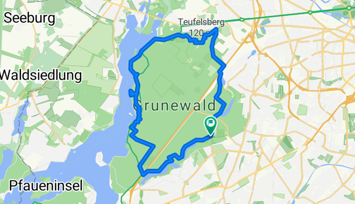
grunewald gross2
Cycling route in Grunewald, State of Berlin, Germany
- 27.9 km
- Distance
- 248 m
- Ascent
- 257 m
- Descent