
My saved routes
A collection of 11 cycling routes, created by Ludwig1966.
Overview
About this collection
This collection contains all routes that were previously saved.
- 11
- Routes
- -:--
- Duration
- 313.9 km
- Distance
- ---
- Avg. speed
- 8,566 m
- Ascent
- 7,055 m
- Descent
created this 9 years ago
My saved routes
Routes in this collection
All 11 routes in this collection can be opened on the map or in the Bikemap App for more details, where you can adjust them in the route planner, or download them as GPX or KML file. Use them as a template for planning your own rides, or let Bikemap navigate you along them directly.

Halblech - Kenzenhütte
Cycling route in Halblech, Bavaria, Germany
- 30.6 km
- Distance
- 1,166 m
- Ascent
- 1,023 m
- Descent

Halblech-Kenzenhütte-Scheineberg uz
Cycling route in Halblech, Bavaria, Germany
- 28.2 km
- Distance
- 693 m
- Ascent
- 693 m
- Descent

füssen-bärmoosalm-breitenberg-füssen
Cycling route in Schwangau, Bavaria, Germany
- 58.5 km
- Distance
- 1,241 m
- Ascent
- 1,241 m
- Descent

Buching Kenzenhütte
Cycling route in Halblech, Bavaria, Germany
- 24.1 km
- Distance
- 927 m
- Ascent
- 768 m
- Descent

Buching Kenzenhütte
Cycling route in Halblech, Bavaria, Germany
- 24.2 km
- Distance
- 631 m
- Ascent
- 637 m
- Descent

Dürrenberger Alm
Cycling route in Breitenwang, Tyrol, Austria
- 5.6 km
- Distance
- 593 m
- Ascent
- 55 m
- Descent

Rund um den Säuling
Cycling route in Musau, Tyrol, Austria
- 37.3 km
- Distance
- 847 m
- Ascent
- 778 m
- Descent

Kaufbeuren-Elbsee und zurück
Cycling route in Kaufbeuren, Bavaria, Germany
- 31.1 km
- Distance
- 330 m
- Ascent
- 254 m
- Descent

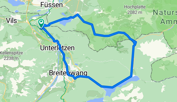
Säuling-Runde
Cycling route in Pflach, Tyrol, Austria
- 43.5 km
- Distance
- 824 m
- Ascent
- 824 m
- Descent

Otto Mayr Hütte
Cycling route in Vils, Tyrol, Austria
- 14.1 km
- Distance
- 770 m
- Ascent
- 237 m
- Descent