
My saved routes
A collection of 13 cycling routes, created by radoman.
Overview
About this collection
This collection contains all routes that were previously saved.
- 13
- Routes
- -:--
- Duration
- 1,431.3 km
- Distance
- ---
- Avg. speed
- 2,545 m
- Ascent
- 2,497 m
- Descent
created this 9 years ago
My saved routes
Routes in this collection
All 13 routes in this collection can be opened on the map or in the Bikemap App for more details, where you can adjust them in the route planner, or download them as GPX or KML file. Use them as a template for planning your own rides, or let Bikemap navigate you along them directly.

2010 - Donau - 02. Tag - Hainburg - Gabčíkovo
Cycling route in Hainburg an der Donau, Lower Austria, Austria
- 64.8 km
- Distance
- 58 m
- Ascent
- 121 m
- Descent

2010 - Donau - 03. Tag - Gabčíkovo - Komárno
Cycling route in Gabčíkovo, Trnava Region, Slovakia
- 59.6 km
- Distance
- 18 m
- Ascent
- 21 m
- Descent

komarno esztergom (DONAU)
Cycling route in Komárom, Komárom-Esztergom, Hungary
- 85.9 km
- Distance
- 553 m
- Ascent
- 547 m
- Descent

Nyergesújfalu - Budapest
Cycling route in Nyergesújfalu, Komárom-Esztergom, Hungary
- 86.7 km
- Distance
- 85 m
- Ascent
- 89 m
- Descent

Budapešť - Balaton - Vídeň
Cycling route in Budapest I. kerület, Budapest, Hungary
- 376.7 km
- Distance
- 624 m
- Ascent
- 561 m
- Descent

Siófok-Balatonfenyves 1. nap
Cycling route in Siófok, Somogy County, Hungary
- 56.8 km
- Distance
- 0 m
- Ascent
- 0 m
- Descent

Horvátország 9 nap
Cycling route in Zalaegerszeg, Zala County, Hungary
- 124.2 km
- Distance
- 145 m
- Ascent
- 236 m
- Descent


Ungarn Etappe 5 (Kapolnasnyek - Budapest)
Cycling route in Kápolnásnyék, Fejér, Hungary
- 52.7 km
- Distance
- 165 m
- Ascent
- 161 m
- Descent
Drau-Mur-Drau (6/10) - D.Dubrava>Maribor
Cycling route in Kotoriba, Međimurje County, Croatia
- 114.7 km
- Distance
- 206 m
- Ascent
- 74 m
- Descent

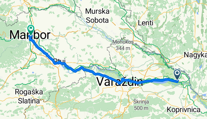
Nagykanizsa-Szepetnek-Letenye-HR-Hodosan-Cakovac-SLO-Ormoz CLONED FROM ROUTE 488910
Cycling route in Nagykanizsa, Zala County, Hungary
- 79.9 km
- Distance
- 146 m
- Ascent
- 104 m
- Descent

Grado
Cycling route in Rožna Dolina, Občina Šempeter-Vrtojba, Slovenia
- 104.3 km
- Distance
- 122 m
- Ascent
- 122 m
- Descent