
My saved routes
A collection of 5 cycling routes, created by Baumsti.
Overview
About this collection
This collection contains all routes that were previously saved.
- 5
- Routes
- -:--
- Duration
- 368.4 km
- Distance
- ---
- Avg. speed
- 7,500 m
- Ascent
- 7,398 m
- Descent
Baumsti
created this 9 years ago
My saved routes
Routes in this collection
All 5 routes in this collection can be opened on the map or in the Bikemap App for more details, where you can adjust them in the route planner, or download them as GPX or KML file. Use them as a template for planning your own rides, or let Bikemap navigate you along them directly.

Wels-Steyr am Voralpenweg
Cycling route in Thalheim bei Wels, Upper Austria, Austria
From the town square of Wels to the town square of Steyr: The route goes briefly along the Traun through the residential area of Wels to the start of the well-signposted 'Voralpenradweg' with the number R12. This winds downhill and uphill through the hilly pre-Alpine landscape on little-traveled si…
- 52.8 km
- Distance
- 420 m
- Ascent
- 417 m
- Descent
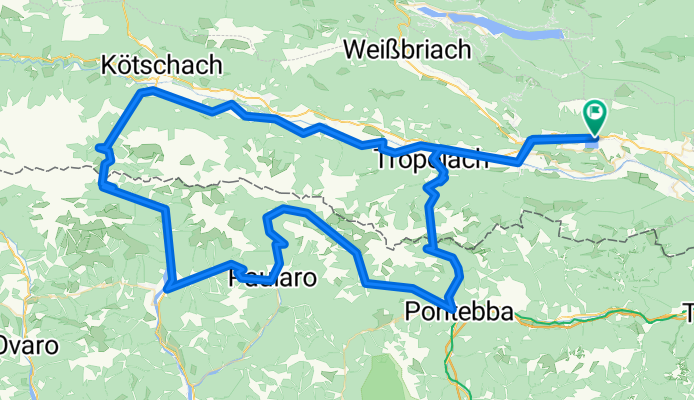
Presseggersee -Plöckenpass-Nassfeld-Presseggersee
Cycling route in Hermagor, Carinthia, Austria
Scenic tour from Austria to Italy and back.
In Italy, the paths are unfortunately not as good as in Austria.
From Paluzza to Passo del Cason di Lanza very steep climbs, sometimes over 18%.
No mobile reception.
Climbing from Italy over Nassfeldpass is also very steep!
- 148.6 km
- Distance
- 3,187 m
- Ascent
- 3,185 m
- Descent

Kremstal-Steyrtal
Cycling route in Ansfelden, Upper Austria, Austria
- 83.1 km
- Distance
- 711 m
- Ascent
- 639 m
- Descent

Rund um den Traunstein
Cycling route in Gmunden, Upper Austria, Austria
As always, biking is not allowed everywhere here, in some places it is even explicitly forbidden! On the way to Kaltenbach there is no path – so you have to go straight through the forest.
- 57.7 km
- Distance
- 1,637 m
- Ascent
- 1,638 m
- Descent

Schobersteinhaus und Grünburger Hütte
Cycling route in Ternberg, Upper Austria, Austria
Von Trattenbach (Wallnermühle 325m) bis zum Schobersteinhaus 1260m ist der Weg mit Schoberstein-Trophy (rote Schilder) beschildert. 10,4km mit einer Steigung von ca. 10%. Eine interessante Pasage ist der Schreibachfall mit ca 20%Steigung für 200m.
Als zweite Hütte bietet sich ein kl…
- 26.2 km
- Distance
- 1,546 m
- Ascent
- 1,519 m
- Descent