For your mountain bike
Shred the world’s best mountain bike trails
From rooty forest loops to alpine descents—these are the highest-rated MTB routes shared by riders like you. Get ready to ride.
 Schliersee - Rohnberg - Neuhaus
- Distance
- 29.5 km
- Ascent
- 1,140 m
- Descent
- 1,144 m
- Location
- Schliersee, Bavaria, Germany
 Bad Wiessee - Lengries - Glashütte - Scharling
- Distance
- 52.7 km
- Ascent
- 1,346 m
- Descent
- 1,346 m
- Location
- Bad Wiessee, Bavaria, Germany
 9-11 Trail: Coaldale to Coplay
- Distance
- 58.3 km
- Ascent
- 710 m
- Descent
- 914 m
- Location
- Coaldale, Pennsylvania, United States of America
 9-11 Trail (Maryland)
- Distance
- 55.8 km
- Ascent
- 1,143 m
- Descent
- 648 m
- Location
- Fort Ashby, West Virginia, United States of America
 Route to 11769 Tundra Drive, Truckee, CA 96161
- Distance
- 25.3 km
- Ascent
- 640 m
- Descent
- 642 m
- Location
- Truckee, California, United States of America
 Upper Stagecoach Trail, Auburn to Upper Stagecoach Trail, Auburn
- Distance
- 16.7 km
- Ascent
- 626 m
- Descent
- 627 m
- Location
- Auburn, California, United States
 Madrid - Zipacón + 3km vía férrea - Madrid
- Distance
- 50.3 km
- Ascent
- 574 m
- Descent
- 600 m
- Location
- Madrid, Cundinamarca, Colombia
 Ruta tranquila en
- Distance
- 30.4 km
- Ascent
- 2,423 m
- Descent
- 2,381 m
- Location
- Ipiales, Departamento de Nariño, Colombia
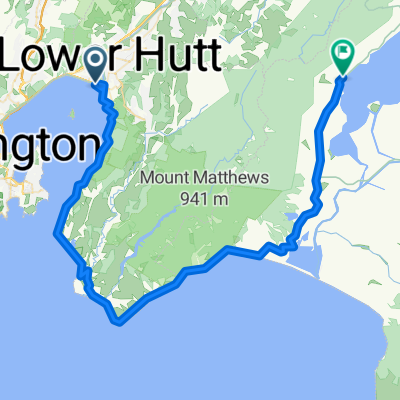 Petone - Upper Hutt
- Distance
- 73.1 km
- Ascent
- 830 m
- Descent
- 799 m
- Location
- Petone, Wellington, New Zealand
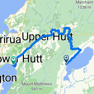 Upper Hutt - Petone
- Distance
- 68.4 km
- Ascent
- 1,066 m
- Descent
- 1,094 m
- Location
- Upper Hutt, Wellington, New Zealand
 Day 1: Kidman Trail - Willunga to Rocky Creek Hut
- Distance
- 37 km
- Ascent
- 519 m
- Descent
- 240 m
- Location
- McLaren Vale, South Australia, Australia
 Apollo Bay - Gellibrand (55 km, 1040 vm)
- Distance
- 55.1 km
- Ascent
- 1,434 m
- Descent
- 1,357 m
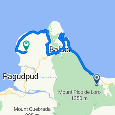 racer
racer- Distance
- 37.5 km
- Ascent
- 1,005 m
- Descent
- 1,084 m
- Location
- Adams, Ilocos, Philippines
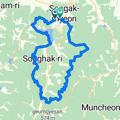 21 외곡마을임도
- Distance
- 41 km
- Ascent
- 2,349 m
- Descent
- 2,360 m
- Location
- Asan, Chungcheongnam-do, South Korea
 rachnahalli lake
- Distance
- 12.9 km
- Ascent
- 870 m
- Descent
- 875 m
- Location
- Yelahanka, Karnataka, India
 Jalan Professor A. Majid Ibrahim 4, Kota Juang to Jalan Professor A. Majid Ibrahim 4, Kota Juang
- Distance
- 18.6 km
- Ascent
- 434 m
- Descent
- 399 m
- Location
- Bireun, Special Region of Aceh, Indonesia
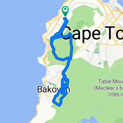 über Camps Bay
- Distance
- 18.9 km
- Ascent
- 818 m
- Descent
- 818 m
- Location
- Cape Town, Western Cape, Republic of South Africa
 111111
- Distance
- 34.2 km
- Ascent
- 491 m
- Descent
- 507 m
- Location
- Plettenberg Bay, Western Cape, Republic of South Africa
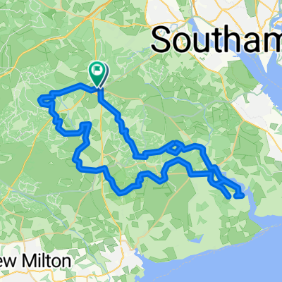 Unnamed Road do High Street
- Distance
- 58.9 km
- Ascent
- 437 m
- Descent
- 434 m
- Location
- Lyndhurst, England, United Kingdom
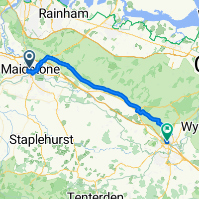 Station Road, Maidstone to M20, Ashford
- Distance
- 38.6 km
- Ascent
- 603 m
- Descent
- 580 m
- Location
- Maidstone, England, United Kingdom