For your road bike
Ride the world's best road cycling routes
From legendary alpine passes to rolling coastal highways—these are the top-rated road bike routes from the Bikemap community. Get inspired and ride your perfect line.
 solčavska panoramska cesta 1
- Distance
- 30.6 km
- Ascent
- 2,075 m
- Descent
- 2,074 m
- Location
- Solčava, Solčava Municipality, Slovenia
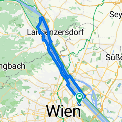 Summer Event
- Distance
- 31.3 km
- Ascent
- 200 m
- Descent
- 200 m
- Location
- Vienna, Vienna, Austria
 Eglinton West Station to Queens Park Via Beltline, Taylor Creek, Boardwalk, Tommy Thompson Park
- Distance
- 47 km
- Ascent
- 282 m
- Descent
- 337 m
- Location
- Toronto, Ontario, Canada
 Tour de Ile-perrot
- Distance
- 118.8 km
- Ascent
- 281 m
- Descent
- 280 m
- Location
- Montreal, Quebec, Canada
 Interurban Trail North, Everett to Alderwood Mall, return
- Distance
- 42.5 km
- Ascent
- 348 m
- Descent
- 322 m
- Location
- Everett, Washington, United States
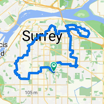 45 km North Delta Whalley Fraser Heights Fleetwood
- Distance
- 46.4 km
- Ascent
- 280 m
- Descent
- 279 m
- Location
- Surrey, British Columbia, Canada
 tablillas
- Distance
- 39.2 km
- Ascent
- 164 m
- Descent
- 176 m
- Location
- Los Chiles, Alajuela Province, Costa Rica
 Ruta moderata
- Distance
- 42.8 km
- Ascent
- 512 m
- Descent
- 538 m
- Location
- La Ensenada, Los Lagos, Chile
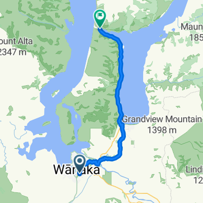 Wanaka
- Distance
- 42.1 km
- Ascent
- 700 m
- Descent
- 610 m
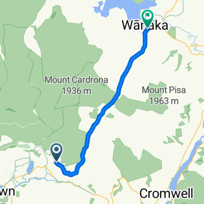 Arrowtown - Wanaka
- Distance
- 45.1 km
- Ascent
- 718 m
- Descent
- 1,057 m
- Location
- Arrowtown, Otago, New Zealand
 Rydalmere to city Cooks River return
- Distance
- 66 km
- Ascent
- 456 m
- Descent
- 449 m
- Location
- Ermington, New South Wales, Australia
 Stafford to Allpass Pde
- Distance
- 40.5 km
- Ascent
- 186 m
- Descent
- 190 m
- Location
- Stafford Heights, Queensland, Australia
 Shatin -> Taipo -> Shatin -> Sai Kung -> Sam Shui Po
- Distance
- 64.1 km
- Ascent
- 619 m
- Descent
- 619 m
- Location
- Shatin, Sha Tin, Hong Kong
 20110702 - 火炭<>上水
- Distance
- 71 km
- Ascent
- 318 m
- Descent
- 266 m
- Location
- Shatin, Sha Tin, Hong Kong
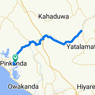
 High-speed route pinkanda -hemmaliya -pinkanda
- Distance
- 32.2 km
- Ascent
- 100 m
- Descent
- 98 m
- Location
- Hikkaduwa, Southern Province, Sri Lanka
 pinkanda-nogoda-pinkanda
- Distance
- 49.7 km
- Ascent
- 300 m
- Descent
- 195 m
- Location
- Hikkaduwa, Southern Province, Sri Lanka
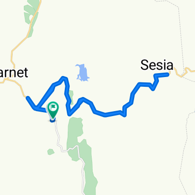 Moderate route
- Distance
- 30.8 km
- Ascent
- 679 m
- Descent
- 674 m
- Location
- Kabarnet, Baringo, Kenya
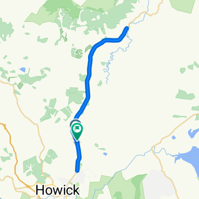 Route in uMngeni
- Distance
- 36 km
- Ascent
- 533 m
- Descent
- 534 m
- Location
- Howick, KwaZulu-Natal, Republic of South Africa
 Oxford - Newbury
- Distance
- 83.2 km
- Ascent
- 738 m
- Descent
- 718 m
- Location
- Oxford, England, United Kingdom
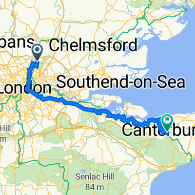 Etapa 028C (Londres - Canterbury)
- Distance
- 149.1 km
- Ascent
- 950 m
- Descent
- 930 m
- Location
- Waltham Abbey, England, United Kingdom