
Cycling in Panhāla
Discover a map of 8 cycling routes and bike trails near Panhāla, created by our community.
Be a pioneer
Inspire fellow cyclists with your route in Panhāla
Bikemap is a global cycling community with millions of routes created by cyclists like you. There are only a few routes so far in Panhāla, so plot your favourite rides on the map now to help others find the best ways to ride.
From our community
The best bike routes in and around Panhāla


Discover more routes
 Recovered Route
- Distance
- 22.7 km
- Ascent
- 306 m
- Descent
- 305 m
- Location
- Panhāla, Maharashtra, India
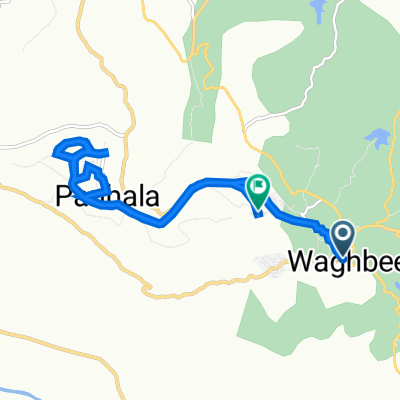
 SH 126, Panhala to SH 126, Panhala
- Distance
- 30 km
- Ascent
- 382 m
- Descent
- 306 m
- Location
- Panhāla, Maharashtra, India
 SH 126, Kolhapur to Panhala, Panhala
- Distance
- 15.8 km
- Ascent
- 314 m
- Descent
- 192 m
- Location
- Panhāla, Maharashtra, India
 Recovered Route
- Distance
- 20 km
- Ascent
- 258 m
- Descent
- 269 m
- Location
- Panhāla, Maharashtra, India