
Cycling in Buriram Province
Discover a map of 32 cycling routes and bike trails in Buriram Province, created by our community.
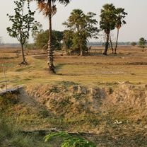
Region portrait
Get to know Buriram Province
Find the right bike route for you through Buriram Province, where we've got 32 cycle routes to explore.
1,925 km
Tracked distance
32
Cycle routes
Community
Most active users in Buriram Province


From our community
The best bike routes in Buriram Province


2445, ตำบล เสม็ด to 2445, ตำบล เสม็ด
Cycling route in Buriram, Buriram Province, Thailand
- 24.3 km
- Distance
- 115 m
- Ascent
- 112 m
- Descent

J029 – Vendredi 03 février 2017 Ban Khok Muang – Chong Chom
Cycling route in Chaloem Phra Kiat, Buriram Province, Thailand
- 91.5 km
- Distance
- 140 m
- Ascent
- 113 m
- Descent

J028C – Jeudi 02 février 2017 - Parc historique Phanom Rung - Ban Khok Muang
Cycling route in Chaloem Phra Kiat, Buriram Province, Thailand
- 8.2 km
- Distance
- 20 m
- Ascent
- 183 m
- Descent

J028B – Jeudi 02 février 2017 - Ban Khok Muang – Parc historique Phanom Rung
Cycling route in Chaloem Phra Kiat, Buriram Province, Thailand
- 7.9 km
- Distance
- 180 m
- Ascent
- 15 m
- Descent
Discover more routes
 J028A – Jeudi 02 février 2017 - Ban Non Charoen – Ban Khok Muang
- Distance
- 27.4 km
- Ascent
- 59 m
- Descent
- 47 m
- Location
- Ban Kruat, Buriram Province, Thailand
 03-Jira Road 511/67, Nai Mueang to Jira Road 511/67, Nai Mueang
- Distance
- 39 km
- Ascent
- 84 m
- Descent
- 85 m
- Location
- Buriram, Buriram Province, Thailand
 Slow ride in Tambon Sakae Sam
- Distance
- 7.2 km
- Ascent
- 31 m
- Descent
- 25 m
- Location
- Huai Rat, Buriram Province, Thailand
 Buri Ram nach Da Nang
- Distance
- 946.1 km
- Ascent
- 2,974 m
- Descent
- 3,128 m
- Location
- Buriram, Buriram Province, Thailand
 ราษฎร์บำรุง 182, ตำบลประโคนชัย to ราษฎร์บำรุง 182, ตำบลประโคนชัย
- Distance
- 49.7 km
- Ascent
- 294 m
- Descent
- 293 m
- Location
- Prakhon Chai, Buriram Province, Thailand
 2445, ตำบล เสม็ด to 2445, ตำบล เสม็ด
- Distance
- 19 km
- Ascent
- 126 m
- Descent
- 157 m
- Location
- Buriram, Buriram Province, Thailand
 สยามพันธ์ุไม้ คูเมือง, ตำบล หนองขมาร to สยามพันธ์ุไม้ คูเมือง, ตำบล หนองขมาร
- Distance
- 13.3 km
- Ascent
- 254 m
- Descent
- 254 m
- Location
- Khu Mueang, Buriram Province, Thailand
 Slow ride in ตำบล ในเมือง
- Distance
- 53.1 km
- Ascent
- 129 m
- Descent
- 137 m
- Location
- Buriram, Buriram Province, Thailand
Cycling regions in Buriram Province
Huai Rat
1 cycling route
Prakhon Chai
2 cycling routes
Nong Hong
1 cycling route
See where people are biking in Thailand
Popular cycling regions in Thailand

