gang family to Jalan Rengas no
- 72.5 km
- 1,100 m
- 1,092 m
- Margahayukencana, West Java, Indonesia

Find the right bike route for you through Margahayukencana, where we've got 401 cycle routes to explore. Most people get on their bikes to ride here in the months of July and August.
Tracked distance
Cycle routes
Population

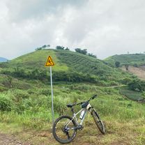
Cycling route in Margahayukencana, West Java, Indonesia

Cycling route in Margahayukencana, West Java, Indonesia


Cycling route in Margahayukencana, West Java, Indonesia

Cycling route in Margahayukencana, West Java, Indonesia