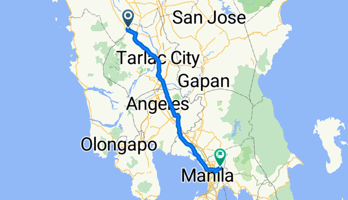

P8FV+7JR, Mangatarem to CCPJ+HCG, San Jose
- 45 km
- 519 m
- 252 m
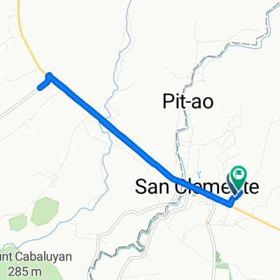
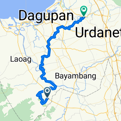
- San Clemente, Central Luzon, Philippines

Find the right bike route for you through San Clemente, where we've got 11 cycle routes to explore.
Tracked distance
Cycle routes
Population
Cycling route in San Clemente, Central Luzon, Philippines
Cycling route in San Clemente, Central Luzon, Philippines
Cycling route in San Clemente, Central Luzon, Philippines
Cycling route in San Clemente, Central Luzon, Philippines