
Cycling in Tahara
Discover a map of 27 cycling routes and bike trails near Tahara, created by our community.
Region portrait
Get to know Tahara
Find the right bike route for you through Tahara, where we've got 27 cycle routes to explore.
876 km
Tracked distance
27
Cycle routes
38,177
Population
Community
Most active users in Tahara


From our community
The best bike routes in and around Tahara


Discover more routes
 のぼリンヒルクラ(滝頭観光道路東口)
- Distance
- 1 km
- Ascent
- 109 m
- Descent
- 26 m
- Location
- Tahara, Aichi, Japan
 length of Japan Tokaido Kakegawa city -Irago cape
- Distance
- 26.4 km
- Ascent
- 111 m
- Descent
- 141 m
- Location
- Tahara, Aichi, Japan
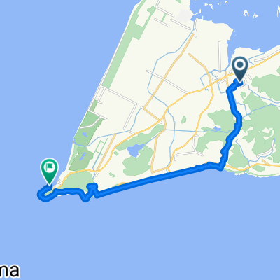
 atsumi-irago
- Distance
- 27.6 km
- Ascent
- 577 m
- Descent
- 391 m
- Location
- Tahara, Aichi, Japan
 atsumi-irago
- Distance
- 14.9 km
- Ascent
- 259 m
- Descent
- 273 m
- Location
- Tahara, Aichi, Japan
 あかばねロコステーション-伊良湖岬
- Distance
- 55.3 km
- Ascent
- 138 m
- Descent
- 137 m
- Location
- Tahara, Aichi, Japan
 Toshime to Utumi
- Distance
- 21 km
- Ascent
- 259 m
- Descent
- 268 m
- Location
- Tahara, Aichi, Japan
 はしリンロング(半島一周)
- Distance
- 101.8 km
- Ascent
- 624 m
- Descent
- 627 m
- Location
- Tahara, Aichi, Japan
 赤羽ロコステーション-伊良湖岬一周
- Distance
- 50.9 km
- Ascent
- 215 m
- Descent
- 214 m
- Location
- Tahara, Aichi, Japan