
Cycling in Nagoya
Discover a map of 229 cycling routes and bike trails near Nagoya, created by our community.
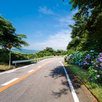
Region portrait
Get to know Nagoya
Find the right bike route for you through Nagoya, where we've got 229 cycle routes to explore. Most people get on their bikes to ride here in the months of July and August.
16,294 km
Tracked distance
229
Cycle routes
2.2 million
Population
Community
Most active users in Nagoya


From our community
The best bike routes in and around Nagoya


Meieki 1-Chōme, Nakamura-Ku, Nagoya-Shi to 7, Iwabuchi 1-Chōme, Ise-Shi
Cycling route in Nagoya, Aichi, Japan
- 114.7 km
- Distance
- 233 m
- Ascent
- 239 m
- Descent


Discover more routes
 Farol de Irago
- Distance
- 63.4 km
- Ascent
- 350 m
- Descent
- 350 m
- Location
- Nagoya, Aichi, Japan
 10-18-2013_Day45
- Distance
- 115.9 km
- Ascent
- 57 m
- Descent
- 60 m
- Location
- Nagoya, Aichi, Japan
 杁ヶ池公園
杁ヶ池公園- Distance
- 16.8 km
- Ascent
- 157 m
- Descent
- 95 m
- Location
- Nagoya, Aichi, Japan
 Seto route
- Distance
- 74.9 km
- Ascent
- 430 m
- Descent
- 426 m
- Location
- Nagoya, Aichi, Japan
 Skóli to Crossfit
- Distance
- 11.5 km
- Ascent
- 17 m
- Descent
- 85 m
- Location
- Nagoya, Aichi, Japan
 De 4-chōme, Nagoya a Unnamed Road, Kuwana
- Distance
- 27.9 km
- Ascent
- 429 m
- Descent
- 155 m
- Location
- Nagoya, Aichi, Japan
 Nissin route
- Distance
- 57.6 km
- Ascent
- 481 m
- Descent
- 445 m
- Location
- Nagoya, Aichi, Japan
 県道215号, 名古屋市千種区 to 金平町寺中28, 蒲郡市
- Distance
- 58.5 km
- Ascent
- 482 m
- Descent
- 411 m
- Location
- Nagoya, Aichi, Japan