
Cycling in Kōnan
Discover a map of 15 cycling routes and bike trails near Kōnan, created by our community.
Region portrait
Get to know Kōnan
Find the right bike route for you through Kōnan, where we've got 15 cycle routes to explore.
516 km
Tracked distance
15
Cycle routes
100,389
Population
Community
Most active users in Kōnan


From our community
The best bike routes in and around Kōnan


Discover more routes
 イジラ湖
イジラ湖- Distance
- 38.8 km
- Ascent
- 182 m
- Descent
- 78 m
- Location
- Kōnan, Aichi, Japan
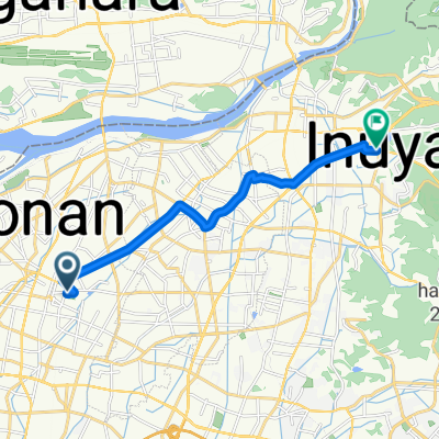
 Izumi, Konan to Daidōhigashi, Ichinomiya
- Distance
- 9.8 km
- Ascent
- 18 m
- Descent
- 27 m
- Location
- Kōnan, Aichi, Japan
 旭 まで杉ノ山
- Distance
- 11.9 km
- Ascent
- 46 m
- Descent
- 41 m
- Location
- Kōnan, Aichi, Japan
 336, Takeda 2-Chōme, Oguchi, Niwa-Gun to 国道156号, Gujo
- Distance
- 38.4 km
- Ascent
- 447 m
- Descent
- 357 m
- Location
- Kōnan, Aichi, Japan
 Kusai, Konan to Kusaicho, Konan
- Distance
- 14.8 km
- Ascent
- 61 m
- Descent
- 62 m
- Location
- Kōnan, Aichi, Japan
 Recovered Route
- Distance
- 28 km
- Ascent
- 119 m
- Descent
- 116 m
- Location
- Kōnan, Aichi, Japan
 336, Takeda 2-Chōme, Oguchi, Niwa-Gun to 158, Maenocho Minami, Konan
- Distance
- 109.5 km
- Ascent
- 1,928 m
- Descent
- 1,931 m
- Location
- Kōnan, Aichi, Japan
 336, Takeda 2-Chōme, Oguchi, Niwa-Gun to 336, Takeda 2-Chōme, Oguchi, Niwa-Gun
- Distance
- 102.6 km
- Ascent
- 1,776 m
- Descent
- 1,775 m
- Location
- Kōnan, Aichi, Japan