
Cycling in Honjō
Discover a map of 17 cycling routes and bike trails near Honjō, created by our community.
Region portrait
Get to know Honjō
Find the right bike route for you through Honjō, where we've got 17 cycle routes to explore.
1,789 km
Tracked distance
17
Cycle routes
61,868
Population
Community
Most active users in Honjō


From our community
The best bike routes in and around Honjō


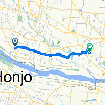
320-7, Nishida, Fukaya to 2-33, Higashidai 5-Chōme, Honjo
Cycling route in Honjō, Saitama, Japan
- 4 km
- Distance
- 16 m
- Ascent
- 16 m
- Descent
Discover more routes
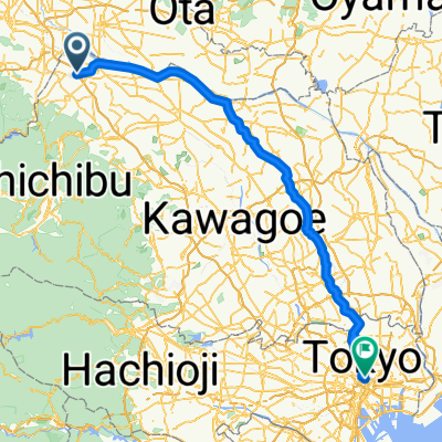
 272, Nishida, Fukaya to 38-81, Kumanocho, Ota
- Distance
- 28.2 km
- Ascent
- 71 m
- Descent
- 59 m
- Location
- Honjō, Saitama, Japan
 富塚町, 伊勢崎市 a 境米岡, 伊勢崎市
- Distance
- 7.9 km
- Ascent
- 3 m
- Descent
- 10 m
- Location
- Honjō, Saitama, Japan
 御荷鉾スーパー林道(本庄~下仁田)
- Distance
- 107.4 km
- Ascent
- 4,875 m
- Descent
- 4,681 m
- Location
- Honjō, Saitama, Japan
 3-chōme 9, Honjo to Kyoto Shiyakusho-mae Station
- Distance
- 449.7 km
- Ascent
- 5,870 m
- Descent
- 5,874 m
- Location
- Honjō, Saitama, Japan
 1423, Yatsutajimamachi, Isesaki to 400, Toriyamashimocho, Ota
- Distance
- 21 km
- Ascent
- 80 m
- Descent
- 83 m
- Location
- Honjō, Saitama, Japan
 本庄ー田園調布 利根川/江戸川ルート
- Distance
- 156.3 km
- Ascent
- 439 m
- Descent
- 463 m
- Location
- Honjō, Saitama, Japan
 本庄ー田園調布
- Distance
- 112.2 km
- Ascent
- 279 m
- Descent
- 300 m
- Location
- Honjō, Saitama, Japan
 七本木, 上里町へ外神田2丁目, 千代田区
- Distance
- 109.1 km
- Ascent
- 224 m
- Descent
- 267 m
- Location
- Honjō, Saitama, Japan