
Cycling in Hatogaya-honchō
Discover a map of 41 cycling routes and bike trails near Hatogaya-honchō, created by our community.
Region portrait
Get to know Hatogaya-honchō
Find the right bike route for you through Hatogaya-honchō, where we've got 41 cycle routes to explore.
1,119 km
Tracked distance
41
Cycle routes
53,062
Population
Community
Most active users in Hatogaya-honchō
From our community
The best bike routes in and around Hatogaya-honchō
Shibakawa Cycling Road
Cycling route in Hatogaya-honchō, Saitama, Japan
- 15.5 km
- Distance
- 96 m
- Ascent
- 88 m
- Descent
Healthy Road へルーシロード
Cycling route in Hatogaya-honchō, Saitama, Japan
This is a very interesting route that has a lot of scenic spots, you can’t help but stop to take a quick picture of Mt.Fuji in the distance or the gates of the various temples.
The route is very flat, it’s very popular too so expect some foot traffic, there are a few bumpy sections especially around the 3K mark and along the 5K to 6K mark but their are alternative roads that go along perpendicular to the route, you just sacrifice the view a little.
I ended this route at the train track crossing but you can go further just expect a lot of narrow paths and stops at crossroads, I cycled beyond the crossing only once on a rainy evening so it was pretty clear of traffic but I can see it being busy on a sunny day and you may have to travel at a snails pace or you may upset some walkers along the narrow sections, it’s just something to keep in mind or note about.
- 13.6 km
- Distance
- 36 m
- Ascent
- 32 m
- Descent
Higashi Urawa River Cycle 東浦和近くの川
Cycling route in Hatogaya-honchō, Saitama, Japan
Mostly flat with quiet roads, between cycling under beautiful trees with the river next to you there are areas of open farmlands with a great view of Saitama Shintoshin skyscrapers in the far distance. It is a very scenic and calm route.
- 14.6 km
- Distance
- 63 m
- Ascent
- 67 m
- Descent
13 芝川で「農」を体感するルート
Cycling route in Hatogaya-honchō, Saitama, Japan
- 12.5 km
- Distance
- 23 m
- Ascent
- 25 m
- Descent
Discover more routes
- 763−2, 川口市 to 1丁目 20, 秩父市
- Distance
- 94 km
- Ascent
- 3,113 m
- Descent
- 2,878 m
- Location
- Hatogaya-honchō, Saitama, Japan
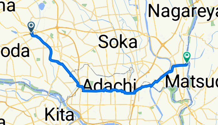
- 18-17, Toneri 1-Chōme, Adachi to 9-7, Nakakasai 6-Chōme, Edogawa
- Distance
- 22.7 km
- Ascent
- 106 m
- Descent
- 110 m
- Location
- Hatogaya-honchō, Saitama, Japan
- 芝川サイクリングロード〜見沼代用水東縁〜見沼自然公園〜〃西縁
- Distance
- 31.6 km
- Ascent
- 78 m
- Descent
- 66 m
- Location
- Hatogaya-honchō, Saitama, Japan
- BRM322-1
- Distance
- 153.1 km
- Ascent
- 990 m
- Descent
- 366 m
- Location
- Hatogaya-honchō, Saitama, Japan
- 一般県道足立さいたま自転車道線(芝川自転車道)
- Distance
- 11.5 km
- Ascent
- 23 m
- Descent
- 20 m
- Location
- Hatogaya-honchō, Saitama, Japan
- 30, Kawaguchi to 5-chōme 12, Kawaguchi
- Distance
- 3 km
- Ascent
- 22 m
- Descent
- 23 m
- Location
- Hatogaya-honchō, Saitama, Japan
- 里, 川口市へ赤塚新町3丁目, 板橋区
- Distance
- 16.4 km
- Ascent
- 91 m
- Descent
- 60 m
- Location
- Hatogaya-honchō, Saitama, Japan
- 2丁目 23, 川口市 to 2丁目 23, さいたま市
- Distance
- 4.1 km
- Ascent
- 3 m
- Descent
- 0 m
- Location
- Hatogaya-honchō, Saitama, Japan