
Cycling in Ashikaga
Discover a map of 17 cycling routes and bike trails near Ashikaga, created by our community.
Region portrait
Get to know Ashikaga
Find the right bike route for you through Ashikaga, where we've got 17 cycle routes to explore.
750 km
Tracked distance
17
Cycle routes
159,671
Population


From our community
The best bike routes in and around Ashikaga

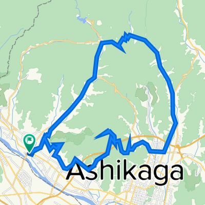
20240928_ぐるとち2024_チャレンジ100kmコース
Cycling route in Ashikaga, Tochigi, Japan
- 101.9 km
- Distance
- 1,662 m
- Ascent
- 1,663 m
- Descent

通2丁目8, 足利市 to 藤岡町赤麻, 栃木市
Cycling route in Ashikaga, Tochigi, Japan
- 24.2 km
- Distance
- 46 m
- Ascent
- 61 m
- Descent
Discover more routes
 907, Imafukucho, Ashikaga to 441-1, Omatacho, Ashikaga
- Distance
- 7.7 km
- Ascent
- 43 m
- Descent
- 11 m
- Location
- Ashikaga, Tochigi, Japan
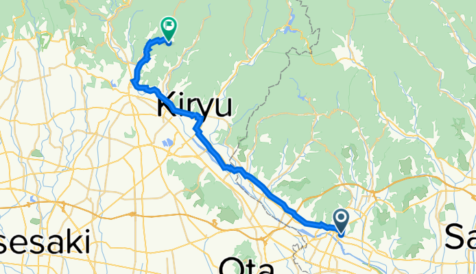
 五十部町265, 足利市 to 境野町2丁目675-3, 桐生市
- Distance
- 10.9 km
- Ascent
- 55 m
- Descent
- 13 m
- Location
- Ashikaga, Tochigi, Japan
 エルディム公幸, Ota to 148-2, Ota
- Distance
- 4.2 km
- Ascent
- 15 m
- Descent
- 3 m
- Location
- Ashikaga, Tochigi, Japan
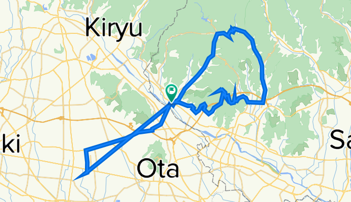
 679-1, Hikomacho, Sano-Shi to 5-47, Honcho 2-Chōme, Tatebayashi-Shi
- Distance
- 27 km
- Ascent
- 91 m
- Descent
- 227 m
- Location
- Ashikaga, Tochigi, Japan
 3, 足利市 to 3, 足利市
- Distance
- 27.3 km
- Ascent
- 159 m
- Descent
- 184 m
- Location
- Ashikaga, Tochigi, Japan
 3, 足利市 to 3, 足利市
- Distance
- 31.8 km
- Ascent
- 383 m
- Descent
- 434 m
- Location
- Ashikaga, Tochigi, Japan
 3, 足利市 to 3, 足利市
- Distance
- 37.6 km
- Ascent
- 205 m
- Descent
- 419 m
- Location
- Ashikaga, Tochigi, Japan
 足利市 to 3, 足利市
- Distance
- 32.3 km
- Ascent
- 402 m
- Descent
- 473 m
- Location
- Ashikaga, Tochigi, Japan