
Cycling in Anjo
Discover a map of 44 cycling routes and bike trails near Anjo, created by our community.
Region portrait
Get to know Anjo
Find the right bike route for you through Anjo, where we've got 44 cycle routes to explore. Most people get on their bikes to ride here in the months of May and June.
867 km
Tracked distance
44
Cycle routes
178,402
Population
Community
Most active users in Anjo


From our community
The best bike routes in and around Anjo


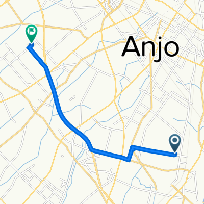
8-1, 百石町 1-Chōme, 安城市 a 9-3, 里町 3-Chōme, 安城市
Cycling route in Anjo, Aichi, Japan
- 5.6 km
- Distance
- 20 m
- Ascent
- 14 m
- Descent

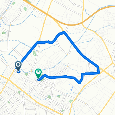
17-11, 里町 3-Chōme, 安城市 a 5-5, 住吉町 3-Chōme, 安城市
Cycling route in Anjo, Aichi, Japan
- 2.5 km
- Distance
- 3 m
- Ascent
- 0 m
- Descent

Discover more routes
 Sakuraicho Sandoyama, Anjo to Takatanacho, Anjo
- Distance
- 7.5 km
- Ascent
- 27 m
- Descent
- 29 m
- Location
- Anjo, Aichi, Japan
 De Higashiyama, Anjo a Washitori, Anjo
- Distance
- 0.7 km
- Ascent
- 0 m
- Descent
- 6 m
- Location
- Anjo, Aichi, Japan
 9, 里町 3-Chōme, 安城市 a 18-1, 長篠町 大山, 知立市
- Distance
- 5.8 km
- Ascent
- 20 m
- Descent
- 16 m
- Location
- Anjo, Aichi, Japan
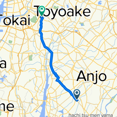 和泉町北本郷189-1, 安城市 to 有松, 名古屋市緑区
- Distance
- 19.6 km
- Ascent
- 112 m
- Descent
- 107 m
- Location
- Anjo, Aichi, Japan
 De 5, Imahommachi 7-Chōme, Anjo-Shi a 4, Satocho 4-Chōme, Anjo-Shi
- Distance
- 6.3 km
- Ascent
- 10 m
- Descent
- 16 m
- Location
- Anjo, Aichi, Japan
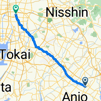 Anjo - Nagoya
- Distance
- 30.5 km
- Ascent
- 168 m
- Descent
- 177 m
- Location
- Anjo, Aichi, Japan
 下之切, 豊田市 to 10丁目, 豊田市
- Distance
- 6.2 km
- Ascent
- 74 m
- Descent
- 51 m
- Location
- Anjo, Aichi, Japan
 茶臼山ツーリング
- Distance
- 207 km
- Ascent
- 2,414 m
- Descent
- 2,414 m
- Location
- Anjo, Aichi, Japan