
Cycling in Tancung
Discover a map of 22 cycling routes and bike trails near Tancung, created by our community.
Region portrait
Get to know Tancung
Find the right bike route for you through Tancung, where we've got 22 cycle routes to explore.
585 km
Tracked distance
22
Cycle routes
Community
Most active users in Tancung


From our community
The best bike routes in and around Tancung

Kalosi - Kalola West Bank
Cycling route in Tancung, South Sulawesi, Indonesia
- 22.5 km
- Distance
- 95 m
- Ascent
- 95 m
- Descent

Gowes Bola Bulu - Pituriawa
Cycling route in Tancung, South Sulawesi, Indonesia
- 14.8 km
- Distance
- 39 m
- Ascent
- 38 m
- Descent

Tanrutedong - Baranti
Cycling route in Tancung, South Sulawesi, Indonesia
- 34 km
- Distance
- 127 m
- Ascent
- 120 m
- Descent
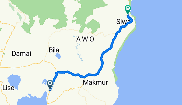
Tancung - Siwa
Cycling route in Tancung, South Sulawesi, Indonesia
- 74.9 km
- Distance
- 324 m
- Ascent
- 318 m
- Descent
Discover more routes
 Jalan Poros Sengkang - Atapange, Majauleng to Jalan Poros Sengkang - Atapange, Majauleng
- Distance
- 6.6 km
- Ascent
- 100 m
- Descent
- 90 m
- Location
- Tancung, South Sulawesi, Indonesia
 Tanrutedong - Pituriase
- Distance
- 30.5 km
- Ascent
- 357 m
- Descent
- 77 m
- Location
- Tancung, South Sulawesi, Indonesia
 Jalan Poros Sengkang - Atapange, Kecamatan Majauleng to X5J8+6CP, Kecamatan Majauleng
- Distance
- 9 km
- Ascent
- 350 m
- Descent
- 381 m
- Location
- Tancung, South Sulawesi, Indonesia
 Sidrap-Parepare-Barru-Soppeng-Sengkang
- Distance
- 240.4 km
- Ascent
- 945 m
- Descent
- 949 m
- Location
- Tancung, South Sulawesi, Indonesia
 Jalan Poros Sengkang - Atapange, Kecamatan Majauleng to X5J8+6CP, Kecamatan Majauleng
- Distance
- 5.5 km
- Ascent
- 210 m
- Descent
- 162 m
- Location
- Tancung, South Sulawesi, Indonesia
 X5J8+6CP, Kecamatan Majauleng to X5JH+FPF, Kecamatan Majauleng
- Distance
- 6.6 km
- Ascent
- 235 m
- Descent
- 185 m
- Location
- Tancung, South Sulawesi, Indonesia
 Rute ngawur-Imaginary route Kalosi-Kalola-Bila
- Distance
- 37.4 km
- Ascent
- 179 m
- Descent
- 179 m
- Location
- Tancung, South Sulawesi, Indonesia
 Jalan Poros Sengkang Atapangnge, Kabupaten Wajo to Jalan Poros Sengkang Atapangnge, Kabupaten Wajo
- Distance
- 15.7 km
- Ascent
- 127 m
- Descent
- 125 m
- Location
- Tancung, South Sulawesi, Indonesia