Cycling in Realejo Alto
Discover a map of 51 cycling routes and bike trails near Realejo Alto, created by our community.
Region portrait
Get to know Realejo Alto
Find the right bike route for you through Realejo Alto, where we've got 51 cycle routes to explore.
2,494 km
Tracked distance
51
Cycle routes
35,963
Population
Community
Most active users in Realejo Alto
From our community
The best bike routes in and around Realejo Alto
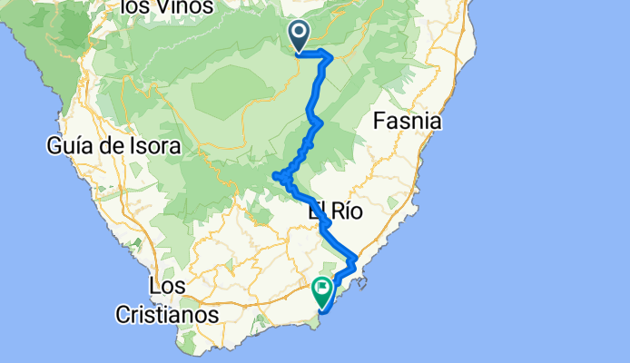
Kraterrandrunde nach El Medano
Cycling route in Realejo Alto, Canary Islands, Spain
- 57.3 km
- Distance
- 512 m
- Ascent
- 2,545 m
- Descent
20151208 El Portillo Mdor Chio Llanos del Hospital Bco de la Arena Piedra de Los Pastores
Cycling route in Realejo Alto, Canary Islands, Spain
- 69.6 km
- Distance
- 1,381 m
- Ascent
- 1,391 m
- Descent
teide2
Cycling route in Realejo Alto, Canary Islands, Spain
- 69.7 km
- Distance
- 1,211 m
- Ascent
- 1,205 m
- Descent
vuelta teide
Cycling route in Realejo Alto, Canary Islands, Spain
- 157.3 km
- Distance
- 3,359 m
- Ascent
- 3,361 m
- Descent
Discover more routes
 Canadas-Höhenweg-Roque de la Grieta
- Distance
- 33.6 km
- Ascent
- 684 m
- Descent
- 684 m
- Location
- Realejo Alto, Canary Islands, Spain
 Canadas-Höhenweg-Roque de la Grieta
- Distance
- 33.6 km
- Ascent
- 685 m
- Descent
- 684 m
- Location
- Realejo Alto, Canary Islands, Spain
 P. Teide: Oben auf dem Rand der Caldera
- Distance
- 53.3 km
- Ascent
- 542 m
- Descent
- 2,554 m
- Location
- Realejo Alto, Canary Islands, Spain
 20151208 El Portillo Mdor Chio Llanos del Hospital Pista del Agujero Piedra de Los Pastores
- Distance
- 71.4 km
- Ascent
- 1,147 m
- Descent
- 1,151 m
- Location
- Realejo Alto, Canary Islands, Spain
 Teneriffa Tour3 30.03.2010
- Distance
- 66.3 km
- Ascent
- 953 m
- Descent
- 2,497 m
- Location
- Realejo Alto, Canary Islands, Spain
 D6E2V2-Long Term short - Esperanza
- Distance
- 21.5 km
- Ascent
- 349 m
- Descent
- 2,151 m
- Location
- Realejo Alto, Canary Islands, Spain
 Teide - Umrundung
- Distance
- 102.6 km
- Ascent
- 1,146 m
- Descent
- 3,151 m
- Location
- Realejo Alto, Canary Islands, Spain
 Dx - Teide Hochebene
- Distance
- 11.4 km
- Ascent
- 448 m
- Descent
- 149 m
- Location
- Realejo Alto, Canary Islands, Spain


