
Cycling in Gádor
Discover a map of 23 cycling routes and bike trails near Gádor, created by our community.
Region portrait
Get to know Gádor
Find the right bike route for you through Gádor, where we've got 23 cycle routes to explore.
3,030 km
Tracked distance
23
Cycle routes
3,002
Population
Community
Most active users in Gádor


From our community
The best bike routes in and around Gádor

GÁDOR-Estación Fuensanta
Cycling route in Gádor, Andalusia, Spain
- 39.3 km
- Distance
- 543 m
- Ascent
- 544 m
- Descent

Gador - Ricaveral - Estacion Fuente Santa
Cycling route in Gádor, Andalusia, Spain
- 41.2 km
- Distance
- 582 m
- Ascent
- 580 m
- Descent


Ruta cinematográfica Tabernas
Cycling route in Gádor, Andalusia, Spain
- 41.7 km
- Distance
- 570 m
- Ascent
- 570 m
- Descent
Discover more routes
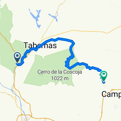
 Gádor - Tabernas
- Distance
- 17.3 km
- Ascent
- 327 m
- Descent
- 83 m
- Location
- Gádor, Andalusia, Spain
 Gádor-Las Balsas-El Hacho-Cerro del Cuchillo-Gatuna-El Moralillo-Las Pedreras-Puente Mocho-Piedra lisa-Gádor
- Distance
- 35.1 km
- Ascent
- 1,018 m
- Descent
- 1,015 m
- Location
- Gádor, Andalusia, Spain
 Gádor-Alhama-vereas II
- Distance
- 32.6 km
- Ascent
- 911 m
- Descent
- 911 m
- Location
- Gádor, Andalusia, Spain
 Gádor-Cerro del Cuchillo-La Veguilla-Puente mocho-Piedra lisa-Gádor
- Distance
- 30.9 km
- Ascent
- 998 m
- Descent
- 995 m
- Location
- Gádor, Andalusia, Spain
 Gador-Alhama-vereda-Gador
- Distance
- 29.2 km
- Ascent
- 748 m
- Descent
- 746 m
- Location
- Gádor, Andalusia, Spain
 Gador - Estación Sta. Fe - Arbol del Ahorcado
- Distance
- 35.6 km
- Ascent
- 504 m
- Descent
- 504 m
- Location
- Gádor, Andalusia, Spain
 Gádor - Níjar
- Distance
- 52.6 km
- Ascent
- 1,114 m
- Descent
- 986 m
- Location
- Gádor, Andalusia, Spain
 Gador Gador por Ricaberal CLONED FROM ROUTE 343344
- Distance
- 57.9 km
- Ascent
- 731 m
- Descent
- 732 m
- Location
- Gádor, Andalusia, Spain