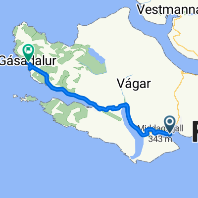
Miðvágur - Vestmanna
- 78.9 km
- 0 m
- 0 m
- Miðvágur, Vágar region, Faroe Islands

Find and create the best bike routes on the Faroe Islands with the bike route planner. The Faroe Islands are located in the sea between Scotland, Iceland and , whereby no spot on the 18 islands is ever more than 5 kilometres away from the sea. Concerning weather, it might be one of the world’s moodiest places - but rides through green, mossy and empty natural landscapes and streets make it worth it.
Tracked distance
Cycle routes
Population
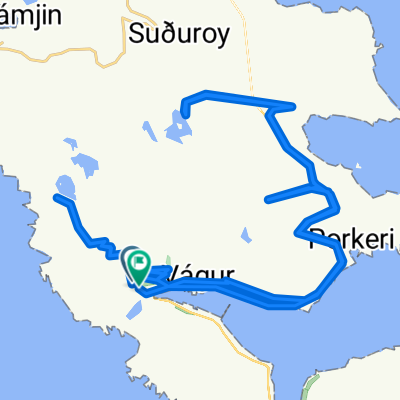
Cycling route in Tvøroyri, Suðuroy region, Faroe Islands
Cycling route in Tvøroyri, Suðuroy region, Faroe Islands
Cycling route in Tvøroyri, Suðuroy region, Faroe Islands
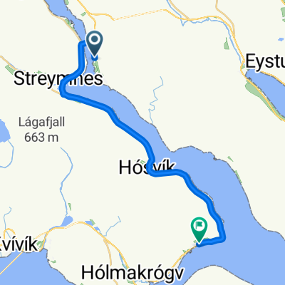
Cycling route in Miðvágur, Vágar region, Faroe Islands