
Cycling in West Hallam
Discover a map of 10 cycling routes and bike trails near West Hallam, created by our community.
Region portrait
Get to know West Hallam
Find the right bike route for you through West Hallam, where we've got 10 cycle routes to explore.
243 km
Tracked distance
10
Cycle routes
6,314
Population
Community
Most active users in West Hallam


From our community
The best bike routes in and around West Hallam

Lockdown route 1
Cycling route in West Hallam, England, United Kingdom
Using as many cycle paths as possible to go from dale abbey to etwall
- 25.3 km
- Distance
- 145 m
- Ascent
- 171 m
- Descent

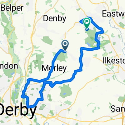
afternoon walk round West Hallam
Cycling route in West Hallam, England, United Kingdom
- 5.2 km
- Distance
- 64 m
- Ascent
- 64 m
- Descent

2023SportiveLongFinal - 2023SportiveLongFinal
Cycling route in West Hallam, England, United Kingdom
- 120 km
- Distance
- 2,277 m
- Ascent
- 2,282 m
- Descent

55–57 Pit Lane, Ilkeston to 201 Pasture Road, Nottingham
Cycling route in West Hallam, England, United Kingdom
- 9.8 km
- Distance
- 105 m
- Ascent
- 129 m
- Descent
Discover more routes
 Foxholes Farm, Spondon Road, Ilkeston to 66 Appledore Ave, Nottingham
- Distance
- 12.6 km
- Ascent
- 83 m
- Descent
- 105 m
- Location
- West Hallam, England, United Kingdom
 Lime Lane to Silk Mill Lane 1
- Distance
- 7.5 km
- Ascent
- 13 m
- Descent
- 123 m
- Location
- West Hallam, England, United Kingdom
 Belper Road, Ilkeston to Old Pit Lane, Heanor
- Distance
- 32.3 km
- Ascent
- 437 m
- Descent
- 470 m
- Location
- West Hallam, England, United Kingdom
 Coronation Road 66, Stanley to Wilders Way
- Distance
- 21.6 km
- Ascent
- 164 m
- Descent
- 175 m
- Location
- West Hallam, England, United Kingdom
 Barley Barn, No Man's Lane, Ilkeston to Hopwell Lodge, Nottingham Road, Derby
- Distance
- 3.4 km
- Ascent
- 42 m
- Descent
- 80 m
- Location
- West Hallam, England, United Kingdom
 Hollies Farm, Spondon Road, Ilkeston to 1–11 Sherwood Ave, Borrowash, Derby
- Distance
- 5.1 km
- Ascent
- 50 m
- Descent
- 101 m
- Location
- West Hallam, England, United Kingdom