
Cycling in Sturry
Discover a map of 70 cycling routes and bike trails near Sturry, created by our community.
Region portrait
Get to know Sturry
Find the right bike route for you through Sturry, where we've got 70 cycle routes to explore. Most people get on their bikes to ride here in the months of May and August.
2,211 km
Tracked distance
70
Cycle routes
4,843
Population


From our community
The best bike routes in and around Sturry

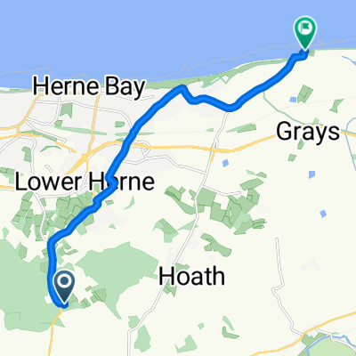
Race to Thieval UK Side
Cycling route in Sturry, England, United Kingdom
- 48.1 km
- Distance
- 209 m
- Ascent
- 204 m
- Descent

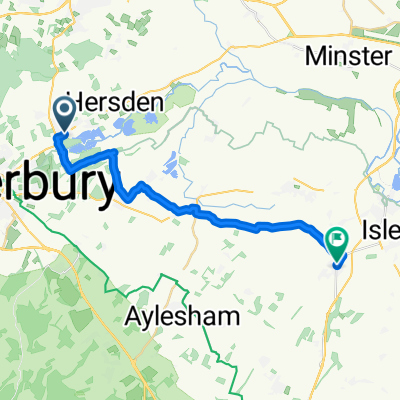
8A Fordwich Road, Canterbury to 36 Burgate, Canterbury
Cycling route in Sturry, England, United Kingdom
- 4.5 km
- Distance
- 3 m
- Ascent
- 0 m
- Descent

76 Shalloak Road, Canterbury to 78 Shalloak Road, Canterbury
Cycling route in Sturry, England, United Kingdom
- 30.5 km
- Distance
- 79 m
- Ascent
- 132 m
- Descent

Canterbury-Paris
Cycling route in Sturry, England, United Kingdom
- 357.3 km
- Distance
- 910 m
- Ascent
- 908 m
- Descent
Discover more routes
 Longmarket 6 to Vauxhall Road 4
- Distance
- 11.9 km
- Ascent
- 79 m
- Descent
- 125 m
- Location
- Sturry, England, United Kingdom
 stodmarsh road circle to IP and Cants
- Distance
- 28.9 km
- Ascent
- 198 m
- Descent
- 243 m
- Location
- Sturry, England, United Kingdom
 6 Ickham Court Farm, The Street, Canterbury to 135 Island Wall, Whitstable
- Distance
- 23.9 km
- Ascent
- 226 m
- Descent
- 236 m
- Location
- Sturry, England, United Kingdom
 Wickhambreaux to Unnamed Road
- Distance
- 21.2 km
- Ascent
- 17 m
- Descent
- 16 m
- Location
- Sturry, England, United Kingdom
 Easy ride in Herne Bay
- Distance
- 10.3 km
- Ascent
- 36 m
- Descent
- 83 m
- Location
- Sturry, England, United Kingdom
 76 Island Road, Canterbury to Vine Cottage, Sandwich Road, Sandwich
- Distance
- 19.7 km
- Ascent
- 3 m
- Descent
- 15 m
- Location
- Sturry, England, United Kingdom
 Moderate route in Canterbury
- Distance
- 16.2 km
- Ascent
- 121 m
- Descent
- 100 m
- Location
- Sturry, England, United Kingdom
 78 Shalloak Road, Canterbury to 78 Shalloak Road, Canterbury
- Distance
- 36 km
- Ascent
- 78 m
- Descent
- 127 m
- Location
- Sturry, England, United Kingdom