
Cycling in Shrewton
Discover a map of 10 cycling routes and bike trails near Shrewton, created by our community.
Region portrait
Get to know Shrewton
Find the right bike route for you through Shrewton, where we've got 10 cycle routes to explore.
461 km
Tracked distance
10
Cycle routes
1,685
Population
Community
Most active users in Shrewton


From our community
The best bike routes in and around Shrewton

Porkers 400 Stage 7
Cycling route in Shrewton, England, United Kingdom
- 72 km
- Distance
- 501 m
- Ascent
- 568 m
- Descent

Hard Boiled Stage 2
Cycling route in Shrewton, England, United Kingdom
- 76.6 km
- Distance
- 537 m
- Ascent
- 579 m
- Descent

Cotswold 6, Shrewton-Hungerford
Cycling route in Shrewton, England, United Kingdom
- 50.5 km
- Distance
- 367 m
- Ascent
- 350 m
- Descent

Shrewton- Hungerford
Cycling route in Shrewton, England, United Kingdom
- 54.5 km
- Distance
- 367 m
- Ascent
- 327 m
- Descent
Discover more routes
 0707_Rollestone-Stonehenge-Salisbury
- Distance
- 25.4 km
- Ascent
- 180 m
- Descent
- 212 m
- Location
- Shrewton, England, United Kingdom
 Route from Black Horse, High Street, Salisbury
- Distance
- 9.7 km
- Ascent
- 204 m
- Descent
- 95 m
- Location
- Shrewton, England, United Kingdom
 3 Candown Road, Salisbury to 12 Chalk Hill, Salisbury
- Distance
- 6.1 km
- Ascent
- 40 m
- Descent
- 54 m
- Location
- Shrewton, England, United Kingdom
 Candown Road, Tilshead, Salisbury to Wyvern Road, Bulford Barracks, Salisbury
- Distance
- 17 km
- Ascent
- 164 m
- Descent
- 165 m
- Location
- Shrewton, England, United Kingdom
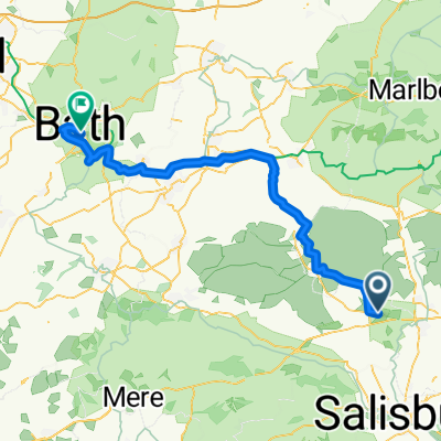 Amesbury, Salisbury to Dorchester Street, Bath
- Distance
- 64.3 km
- Ascent
- 515 m
- Descent
- 603 m
- Location
- Shrewton, England, United Kingdom
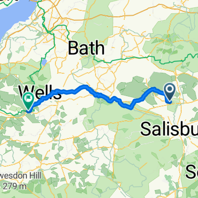 Amesbury, Salisbury to Magdalene Street, Glastonbury
- Distance
- 84.7 km
- Ascent
- 946 m
- Descent
- 1,035 m
- Location
- Shrewton, England, United Kingdom