
Cycling in Robertsbridge
Discover a map of 81 cycling routes and bike trails near Robertsbridge, created by our community.
Region portrait
Get to know Robertsbridge
Find the right bike route for you through Robertsbridge, where we've got 81 cycle routes to explore. Most people get on their bikes to ride here in the months of August and September.
3,990 km
Tracked distance
81
Cycle routes
2,031
Population
Community
Most active users in Robertsbridge


From our community
The best bike routes in and around Robertsbridge

From Robertsbridge to Amsterdam
Cycling route in Robertsbridge, England, United Kingdom
- 558.1 km
- Distance
- 1,358 m
- Ascent
- 1,407 m
- Descent

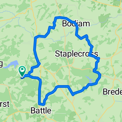
Rye and Winchelsea
Cycling route in Robertsbridge, England, United Kingdom
Easy start to Rye, terrible road surface to Winchelsea.
Gets quite hilly after that.
- 56.9 km
- Distance
- 419 m
- Ascent
- 419 m
- Descent

L2B training
Cycling route in Robertsbridge, England, United Kingdom
Longest ride so far, the route goes via Four Oaks, Wittersham, back on Military Rd to Rye making the route 41.2 miles.
- 65.9 km
- Distance
- 402 m
- Ascent
- 402 m
- Descent

Bodle Street Green
Cycling route in Robertsbridge, England, United Kingdom
Work, Brightling, Bodle Street Green, Penhurst, Netherfield and back to work
- 33.7 km
- Distance
- 401 m
- Ascent
- 401 m
- Descent
Discover more routes
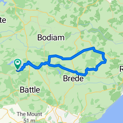
 Bodiam (via Virgin Lane)
- Distance
- 37 km
- Ascent
- 353 m
- Descent
- 353 m
- Location
- Robertsbridge, England, United Kingdom
 Dale Hill
- Distance
- 41.1 km
- Ascent
- 620 m
- Descent
- 622 m
- Location
- Robertsbridge, England, United Kingdom
 Bodle Street - var II
- Distance
- 35.6 km
- Ascent
- 454 m
- Descent
- 454 m
- Location
- Robertsbridge, England, United Kingdom
 Bodiam in reverse
- Distance
- 36.5 km
- Ascent
- 401 m
- Descent
- 401 m
- Location
- Robertsbridge, England, United Kingdom
 Willingdon Lane
- Distance
- 29.7 km
- Ascent
- 458 m
- Descent
- 461 m
- Location
- Robertsbridge, England, United Kingdom
 Peasmarsh without the hill
- Distance
- 45.3 km
- Ascent
- 367 m
- Descent
- 358 m
- Location
- Robertsbridge, England, United Kingdom
 Stonegate
- Distance
- 38.7 km
- Ascent
- 529 m
- Descent
- 531 m
- Location
- Robertsbridge, England, United Kingdom
 Peasmarsh_reverse
- Distance
- 41.7 km
- Ascent
- 371 m
- Descent
- 374 m
- Location
- Robertsbridge, England, United Kingdom