Cycling in Prestonpans
Discover a map of 42 cycling routes and bike trails near Prestonpans, created by our community.
Region portrait
Get to know Prestonpans
Find the right bike route for you through Prestonpans, where we've got 42 cycle routes to explore.
1,639 km
Tracked distance
42
Cycle routes
7,145
Population
Community
Most active users in Prestonpans
From our community
The best bike routes in and around Prestonpans

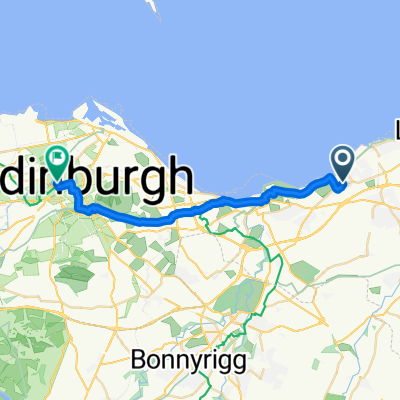
bike tour through Prestonpans
Cycling route in Prestonpans, Scotland, United Kingdom
- 18.1 km
- Distance
- 161 m
- Ascent
- 159 m
- Descent

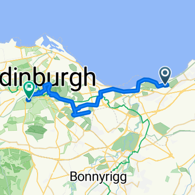
Route to Ferniehill Avenue
Cycling route in Prestonpans, Scotland, United Kingdom
- 16.7 km
- Distance
- 121 m
- Ascent
- 19 m
- Descent

Pans to Oxton - Club ride in the middle !
Cycling route in Prestonpans, Scotland, United Kingdom
- 84.5 km
- Distance
- 506 m
- Ascent
- 293 m
- Descent

B1348, Drummohr, Prestonpans to 1 Milton Link, Edinburgh
Cycling route in Prestonpans, Scotland, United Kingdom
- 8.4 km
- Distance
- 55 m
- Ascent
- 39 m
- Descent
Discover more routes
- Long bike tour from Prestonpans to エディンバラ
- 30.5 km
- 313 m
- 233 m
- Prestonpans, Scotland, United Kingdom
- 14 The Pottery, High St, Prestonpans to 13 The Pottery, High St, Prestonpans
- 54.3 km
- 161 m
- 160 m
- Prestonpans, Scotland, United Kingdom
- 22 Mallard Walk, Prestonpans to 22 Mallard Walk, Prestonpans
- 17.9 km
- 66 m
- 87 m
- Prestonpans, Scotland, United Kingdom
- 13 Mallard Walk, Prestonpans to 1–3 Saint Colme Street, Edinburgh
- 17.5 km
- 90 m
- 50 m
- Prestonpans, Scotland, United Kingdom
- Easy ride in Edinburgh
- 11.8 km
- 0 m
- 3 m
- Prestonpans, Scotland, United Kingdom
- Wallyford to Gullane
- 35.3 km
- 99 m
- 99 m
- Prestonpans, Scotland, United Kingdom
- poppymedium2022
- 109.9 km
- 0 m
- 0 m
- Prestonpans, Scotland, United Kingdom