
Cycling in Morecambe
Discover a map of 249 cycling routes and bike trails near Morecambe, created by our community.
Region portrait
Get to know Morecambe
Find the right bike route for you through Morecambe, where we've got 249 cycle routes to explore. Most people get on their bikes to ride here in the months of July and August.
25,934 km
Tracked distance
249
Cycle routes
51,644
Population
Community
Most active users in Morecambe


Handpicked routes
Discover Morecambe through these collections
Tour
From our community
The best bike routes in and around Morecambe


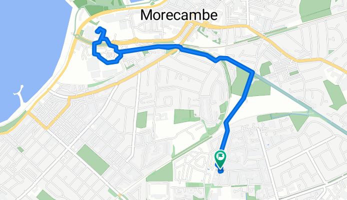
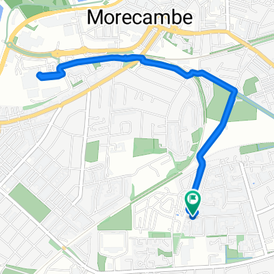
Home - WE prom - Town - Broadway - Home
Cycling route in Morecambe, England, United Kingdom
- 12 km
- Distance
- 29 m
- Ascent
- 83 m
- Descent
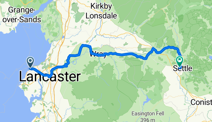
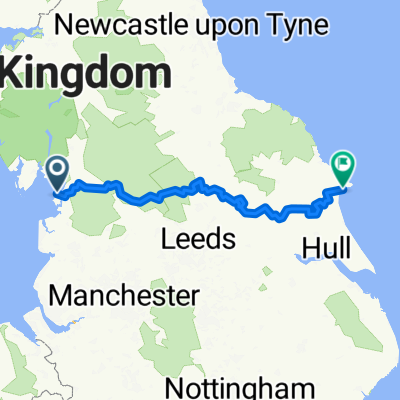
Morecambe - Settle
Cycling route in Morecambe, England, United Kingdom
- 56.5 km
- Distance
- 657 m
- Ascent
- 514 m
- Descent
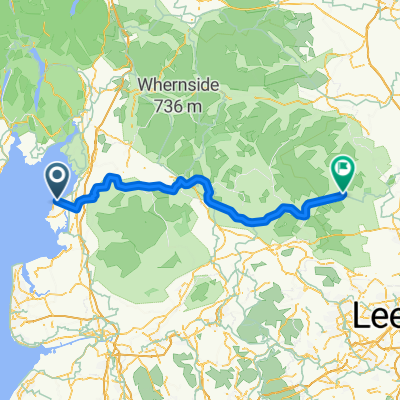
Way Of The Roses
Cycling route in Morecambe, England, United Kingdom
- 280.2 km
- Distance
- 2,463 m
- Ascent
- 2,456 m
- Descent
Easy Sunday afternoon ride
Cycling route in Morecambe, England, United Kingdom
- 4.4 km
- Distance
- 11 m
- Ascent
- 59 m
- Descent
Discover more routes
 Way of the Rose
- Distance
- 310.3 km
- Ascent
- 2,440 m
- Descent
- 2,443 m
- Location
- Morecambe, England, United Kingdom
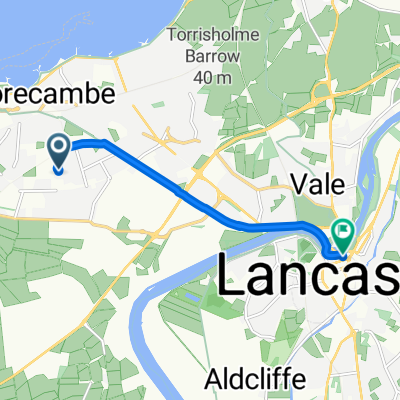 Home to Sainsbury's, Lancaster
- Distance
- 5.1 km
- Ascent
- 20 m
- Descent
- 82 m
- Location
- Morecambe, England, United Kingdom
 Home to Morrisons (a dry start, wet ending)
- Distance
- 4 km
- Ascent
- 6 m
- Descent
- 59 m
- Location
- Morecambe, England, United Kingdom
 Condor Green -Crosgill - Lune Valley - Morecambe Prom
- Distance
- 53.4 km
- Ascent
- 266 m
- Descent
- 267 m
- Location
- Morecambe, England, United Kingdom
 Halton Promenade Circular
- Distance
- 19.7 km
- Ascent
- 101 m
- Descent
- 101 m
- Location
- Morecambe, England, United Kingdom
 Day 1 WOTR
- Distance
- 100.4 km
- Ascent
- 1,504 m
- Descent
- 1,385 m
- Location
- Morecambe, England, United Kingdom
 Bare, Glasson, Gressingham Kellet Circular v2
- Distance
- 66.3 km
- Ascent
- 439 m
- Descent
- 440 m
- Location
- Morecambe, England, United Kingdom
 Moderate route in Morecambe
- Distance
- 25.6 km
- Ascent
- 0 m
- Descent
- 6 m
- Location
- Morecambe, England, United Kingdom
Routes from Morecambe
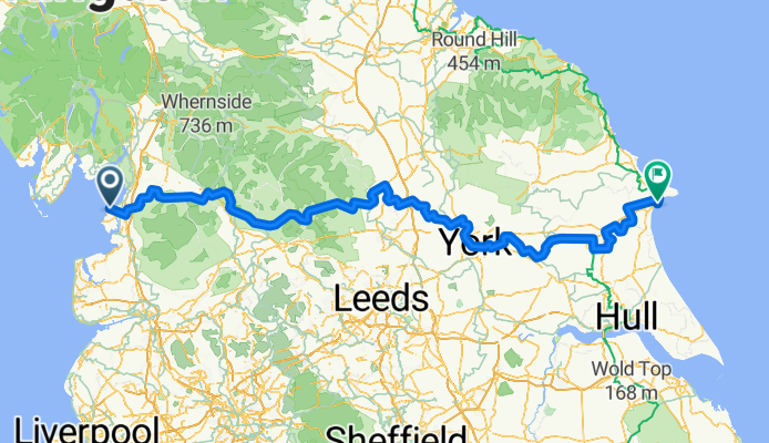
Bikepacking from
Morecambe to Bridlington