
Cycling in Kilmington
Discover a map of 14 cycling routes and bike trails near Kilmington, created by our community.
Region portrait
Get to know Kilmington
Find the right bike route for you through Kilmington, where we've got 14 cycle routes to explore.
618 km
Tracked distance
14
Cycle routes
Community
Most active users in Kilmington


From our community
The best bike routes in and around Kilmington

Stourhead loop
Cycling route in Kilmington, England, United Kingdom
- 37.5 km
- Distance
- 513 m
- Ascent
- 512 m
- Descent


Sourhead to campsite via mere
Cycling route in Kilmington, England, United Kingdom
- 8.5 km
- Distance
- 14 m
- Ascent
- 97 m
- Descent
lymington route one
Cycling route in Kilmington, England, United Kingdom
- 97.9 km
- Distance
- 553 m
- Ascent
- 662 m
- Descent
Discover more routes
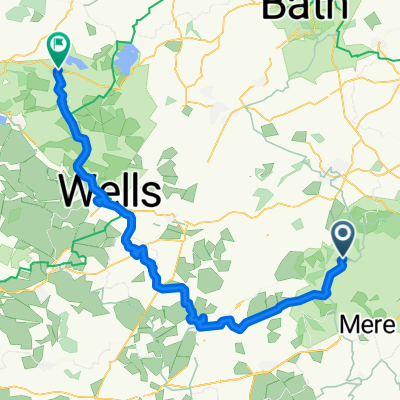
 King Alfreds Tower to Frome
- Distance
- 23.5 km
- Ascent
- 284 m
- Descent
- 434 m
- Location
- Kilmington, England, United Kingdom
 Tower Road, Bruton to Tower Road, Bruton
- Distance
- 18.5 km
- Ascent
- 403 m
- Descent
- 398 m
- Location
- Kilmington, England, United Kingdom
 Stourhead to Bournemouth
- Distance
- 72 km
- Ascent
- 473 m
- Descent
- 668 m
- Location
- Kilmington, England, United Kingdom
 Figure_of_Hate
- Distance
- 33.3 km
- Ascent
- 419 m
- Descent
- 418 m
- Location
- Kilmington, England, United Kingdom
 Kilmington - Blagdon
- Distance
- 64.4 km
- Ascent
- 781 m
- Descent
- 842 m
- Location
- Kilmington, England, United Kingdom
 Kilmington Common, Kilmington, Warminster to A361, Cranmore, East Cranmore, Shepton Mallet
- Distance
- 17.3 km
- Ascent
- 297 m
- Descent
- 346 m
- Location
- Kilmington, England, United Kingdom
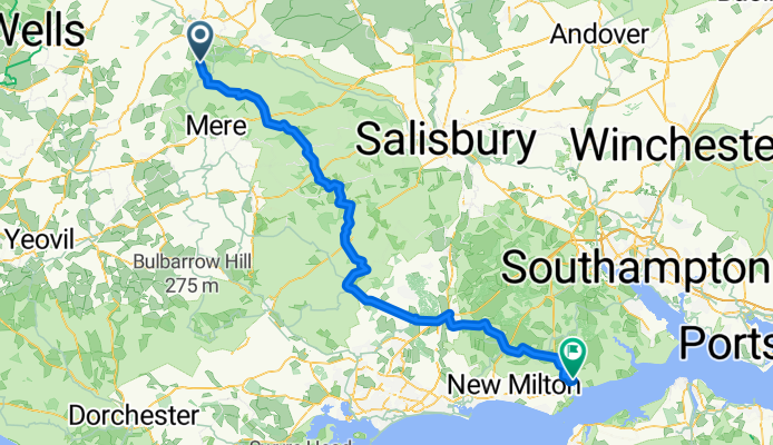
 stourton to Hengistbury head
- Distance
- 69.7 km
- Ascent
- 498 m
- Descent
- 676 m
- Location
- Kilmington, England, United Kingdom
 Tower Road, Kilmington, Warminster to A371, Ditcheat, Evercreech, Shepton Mallet
- Distance
- 17.9 km
- Ascent
- 1,028 m
- Descent
- 1,193 m
- Location
- Kilmington, England, United Kingdom