
Cycling in Greenhead
Discover a map of 22 cycling routes and bike trails near Greenhead, created by our community.
Region portrait
Get to know Greenhead
Find the right bike route for you through Greenhead, where we've got 22 cycle routes to explore.
2,296 km
Tracked distance
22
Cycle routes

From our community
The best bike routes in and around Greenhead

Greenhead-Corebridge (Hadrians Wall Day 2)
Cycling route in Greenhead, England, United Kingdom
- 58.6 km
- Distance
- 355 m
- Ascent
- 500 m
- Descent

england-7-gilsland-newcastleton
Cycling route in Greenhead, England, United Kingdom
- 34.9 km
- Distance
- 398 m
- Ascent
- 411 m
- Descent

Route 3, July 2018
Cycling route in Greenhead, England, United Kingdom
- 76.8 km
- Distance
- 1,193 m
- Ascent
- 1,113 m
- Descent

Recovered Route
Cycling route in Greenhead, England, United Kingdom
- 1,217.2 km
- Distance
- 378 m
- Ascent
- 455 m
- Descent
Discover more routes
 Cumbrian roads
- Distance
- 54.3 km
- Ascent
- 365 m
- Descent
- 367 m
- Location
- Greenhead, England, United Kingdom
 furls2
- Distance
- 73.9 km
- Ascent
- 345 m
- Descent
- 499 m
- Location
- Greenhead, England, United Kingdom
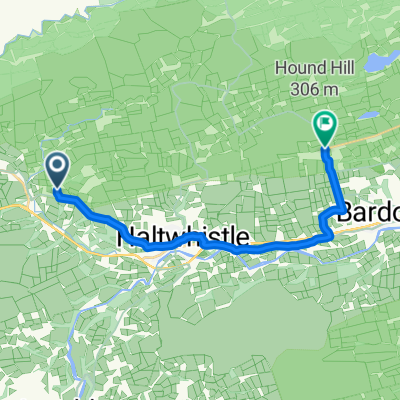
 Gilsland to Haltwhistle 6mi 500ft
- Distance
- 10 km
- Ascent
- 125 m
- Descent
- 104 m
- Location
- Greenhead, England, United Kingdom
 Dag 2_86 km
- Distance
- 86.9 km
- Ascent
- 213 m
- Descent
- 354 m
- Location
- Greenhead, England, United Kingdom
 Greenhead Cycling
- Distance
- 48.4 km
- Ascent
- 725 m
- Descent
- 734 m
- Location
- Greenhead, England, United Kingdom
 Carvoran House Cottage, Brampton to B6318, Hexham
- Distance
- 14 km
- Ascent
- 296 m
- Descent
- 284 m
- Location
- Greenhead, England, United Kingdom
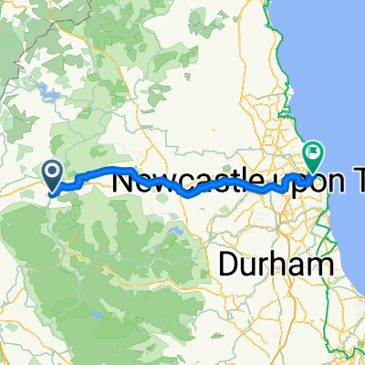 Haltwhistle Camping and Caravanning Club Site to Beach Road
- Distance
- 87.7 km
- Ascent
- 667 m
- Descent
- 778 m
- Location
- Greenhead, England, United Kingdom
 2e dag alternatief 68 km
- Distance
- 123.1 km
- Ascent
- 182 m
- Descent
- 310 m
- Location
- Greenhead, England, United Kingdom