
Cycling in Curry Rivel
Discover a map of 30 cycling routes and bike trails near Curry Rivel, created by our community.
Region portrait
Get to know Curry Rivel
Find the right bike route for you through Curry Rivel, where we've got 30 cycle routes to explore.
1,481 km
Tracked distance
30
Cycle routes
1,847
Population
Community
Most active users in Curry Rivel

From our community
The best bike routes in and around Curry Rivel

Burrow+Windmill hill
Cycling route in Curry Rivel, England, United Kingdom
- 34.4 km
- Distance
- 185 m
- Ascent
- 188 m
- Descent

burrow hill round trip
Cycling route in Curry Rivel, England, United Kingdom
- 18.7 km
- Distance
- 94 m
- Ascent
- 99 m
- Descent

day out 8/6/20
Cycling route in Curry Rivel, England, United Kingdom
- 50.7 km
- Distance
- 272 m
- Ascent
- 272 m
- Descent

Athelney/Stathe 3m
Cycling route in Curry Rivel, England, United Kingdom
- 4.9 km
- Distance
- 4 m
- Ascent
- 0 m
- Descent
Discover more routes
 Stathe Road to Stathe Road
- Distance
- 33.6 km
- Ascent
- 31 m
- Descent
- 132 m
- Location
- Curry Rivel, England, United Kingdom
 Stathe Circ to Wst 44m
- Distance
- 70.2 km
- Ascent
- 342 m
- Descent
- 344 m
- Location
- Curry Rivel, England, United Kingdom
 Ham Hill Loop
- Distance
- 11.7 km
- Ascent
- 106 m
- Descent
- 103 m
- Location
- Curry Rivel, England, United Kingdom
 Barnsby
- Distance
- 20.9 km
- Ascent
- 100 m
- Descent
- 52 m
- Location
- Curry Rivel, England, United Kingdom
 North Street 6, Drayton to Ivy Cottages 1, Culmhead
- Distance
- 25.7 km
- Ascent
- 437 m
- Descent
- 194 m
- Location
- Curry Rivel, England, United Kingdom
 Barrow Mump Stathe 25m
- Distance
- 39.8 km
- Ascent
- 192 m
- Descent
- 192 m
- Location
- Curry Rivel, England, United Kingdom
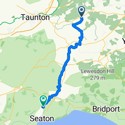 Curry Rivel - Colyton
- Distance
- 47.8 km
- Ascent
- 454 m
- Descent
- 487 m
- Location
- Curry Rivel, England, United Kingdom
 Culmstock - direct
- Distance
- 40.1 km
- Ascent
- 369 m
- Descent
- 288 m
- Location
- Curry Rivel, England, United Kingdom